
Hoffman, Knickerbocker and Co. (sold)

Hoffman, Knickerbocker and Co. (1856 - 1862) were lithographer and engravers based in Albany, New York. They were active at least from 1856 and as late as 1862. He firm was operated by Abraham J. Hoffman (1834 - 18??). The 'and Co.' was probably Richard H. Pease, another Albany lithographer. The firm may have been preceded by Hoffman and Co. the partnership dissolved in 1862 when Hoffman relocated to Chicago. Their corpus consisted of government publications, sheet music, book covers, maps, stationary, decorative lithographs, and more.
Who owns New York City? City or State?
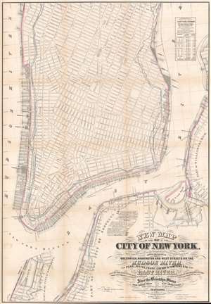
New Map of that Part of the City of New York south from 20th Street on the Hudson and 35th Street on the East River.
sold
- Digital Map Information
- Suitable for large format printing
- File Size: 45.27 MB
- File Type: ZIP / TIFF
- ICC color profile embedded
- Delivered instantly via download link
This is a rare map drawn to settle a land rights dispute between New York City and New York State. The map extends from roughly 32nd street to the Battery and includes the shorelines of Brooklyn and Queens. It illustrates the city's street grid, showing all piers and docks, ferry lines, and the pier line. Most importantly, it illustrates the cities original boundary line, noting both the high and low water marks (this was one of the maps consulted by Egbert Viele to produce the famous 1865 Waterways Map). More importantly, it illustrates the shore boundaries of Manhattan and Brooklyn according to the various surveys and charters completed between 1735 and 1808. (more details)
Now the site of Brookfield Place Mall.
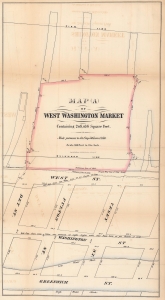
Map (A) of West Washington Market Containing 208,036 Square Feet.
sold
- Digital Map Information
- Suitable for large format printing
- File Size: 15.21 MB
- File Type: ZIP / TIFF
- ICC color profile embedded
- Delivered instantly via download link
This is a fascinating 1862 Hoffman and Knickerbocker map of the West Washington Market in Lower Manhattan - a little-known page in NYC lore. This market, which housed stalls for private merchants and had its own 'street grid', stood where Brookfield Place Mall is today. (more details)