
Jones, Edward (sold)

Edward Jones (fl. c. 1799 - 1818) was an English engraver active in London during the early part of the 19th century. Jones was born in London, the son of carpenter. He apprenticed first under the engraver Thomas Orphin and later, after Orphin's death, under William Palmer. In 1799, Jones partnered with Benjamin Smith, publishing as alternatively 'Jones and Smith' or 'Smith and Jones.' Around 1801 a third partner, Joseph Bye, was added, and the imprint changed to 'Jones, Smith and Bye' or 'Jones Smith and Company.' The firm dissolved in 1804 when Smith and Bye were captured by French privateers and imprisoned for 4 years while on business trip to Portugal. Jones lived in Newington (London) where he was neighbor of the important engraver and publisher John Rapkin.
Rare Spanish nautical chart of the Balearic Islands.
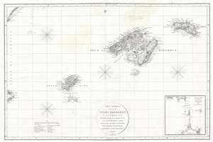
Carta Esferica de las Islas Baleares y Pithyusas, arreglada a la que se construyo en 1807 en la Dirección Hidrografica de Madrid.
sold
- Digital Map Information
- Suitable for large format printing
- DPI: 300
- File Size: 10.36 MB
- File Type: ZIP / TIFF
- ICC color profile embedded
- Delivered instantly via download link
A rare 1812 Dirección de Hidrografía nautical chart or maritime map of the Balearic Islands: Mallorca, Menorca, Ibiza and Formentera. The chart offers extraordinarily detail throughout with topography, town names rivers, roads, and depth soundings. An inset in ... (more details)
Rare Spanish nautical chart of the Balearic Islands.
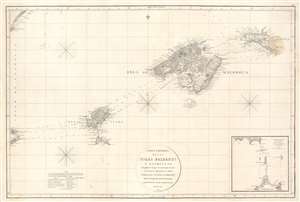
Carta Esferica de las Islas Baleares y Pithyusas, arreglada a la que se construyo en 1807 en la Dirección Hidrografica de Madrid.
sold
- Digital Map Information
- Suitable for large format printing
- Full resolution TIFF file
- ICC color profile embedded
- Delivered instantly via download link
A rare 1812 Dirección de Hidrografía nautical chart or maritime map of the Balearic Islands: Mallorca, Minorca, Ibiza and Formentera. The chart offers extraordinarily detail throughout with topography, town names rivers, roads, and depth soundings. An inset in the lower right details the channels between Ibiza and Formentera (1 : 69400). (more details)