
Jones, James Felix (sold)

James Felix Jones (September 5, 1813 - September 3, 1878) was British officer of the East India Company and the Indian Navy. He served as surveyor, and amateur archeologist active in the Middle East in the mid-19th century. He was born in Shoreditch, London, England. He joined the Bombay Marine at 14, where an aptitude at mathematics led him to be taught surveying. He became involved in various British survey projects throughout the Middle East. As a midshipman on the RIMS Palinurus, he completed a series of surveys of the Red Sea littoral. By the 1820s, he was reassigned to the Persian Gulf, where he worked on the first British survey of those waters. In 1839, he surveyed Kuwait harbor. In addition to his military surveys, he accompanied Henry Creswicke Rawlinson on an overland journey from Baghdad to Hamadān, along the way producing a series of seminal archeological surveys of the ruins of antiquity. These included including the course of the ancient Nahrwan Canal (1848), the course of the Tigris and what he believed to be the site of Opis (1850), the Assyrian heartland (1852), Nimrud and Nineveh (1852), and the Baghdad area (1853). With years of Middle East experience behind him, Jones was assigned the position of Political Agent in the Persian Gulf. It has been argued that, in this capacity, he played a role in the British invasion of Persia (1856 - 1857). He retired from active service in 1862, suffering ill health and returning to London. He settled in Upper Norwood, Surrey, where he nonetheless continued to produce geographical work for the India Office. In 1875, he completed a beautifully drawn map of western Asia, including the valleys of the Tigris and Euphrates, which survives in manuscript but remains unpublished. Jones' 1878 Geographical Magazine obituary called him 'one of the greatest ornaments of the old Indian Navy'.
Vestiges of Assyria.
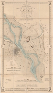
Vestiges of Assyria, sheet 1st, an ichnographic sketch of the remains of ancient Nineveh with the enceinte of the modern Mosul, the [Arabic inscription] of Arab M.S.S. and the ΜΕΣПΙΛΑ of the Anabasis constructed from the trigonometrical survey in the spring of 1852 at the command of the government of India.
sold
- Digital Map Information
- Suitable for large format printing
- File Size: 1761.26 MB
- File Type: ZIP / TIFF
- ICC color profile embedded
- Delivered instantly via download link
A striking 1855 ichnographic map of Mosul, Iraq, and the neighboring excavations at the ancient Assyrian capital of Nineveh. This map is significant, not only as one of the first modern surveys of Mosul, but also for its premier cartographic representation of the seminal archeological excavations at Nineveh performed by Austen Henry Layard. These excavations produced several paradigm-breaking discoveries, including the Epic of Gilgamesh and pre-Biblical 'Great Flood' narratives. (more details)
Vestiges of Assyria.
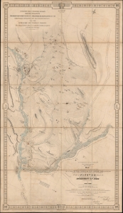
Vestiges of Assyria, sheet 3rd, being a Map of the Country in the Angle Formed by the River Tigris and the Upper Zab shewing the disposition of the various ancient sites in the vicinity of Nineveh from trigonometrical survey made by order of the Government of India in the spring of 1852.
sold
- Digital Map Information
- Suitable for large format printing
- File Size: 1789.73 MB
- File Type: ZIP / TIFF
- ICC color profile embedded
- Delivered instantly via download link
A very impressive 1855 map of the upper Tigris flood plain in the vicinity of Mosul, Iraq. The map is one of three prepared by James Felix Jones to illustrate the seminal Austen Henry Layard excavations at ancient Assyrian royal capitals of Nineveh and Nimrud, as well as the palace complex at Khorsabad. These excavations produced several paradigm-breaking discoveries, including the Epic of Gilgamesh and pre-Biblical 'Great Flood' narratives. (more details)