
Jorge, Luiz de Barbuda (sold)

Luiz Jorge de Barbuda (1564? - 1613? ) was a Portuguese cartographer. He is known primarily as the individual credited by Abraham Ortelius as the source for During his 1584 map of China, the first map specifically of China to appear in an atlas. Little is known of his early history and there is little agreement by scholars on his dates. It is understood that he was, in 1582, commissioned by Philip II of Spain to produce navigation charts and world maps. His role as an official cartographer for Spain makes the appearance of his map in Ortelius' atlas all the more remarkable: The Spanish were reluctant to share any of their cartographic information and printed virtually none of it in the 16th and 17th centuries. Nevertheless, his Chinaeappeared in Ortelius' Theatrum Orbis Terrarum accompanied by a brief description of China and its language, derived from Bernardino de Escalante's 1577 Discurso de la navegacion que los Portugueses hacen a los Reinos y Provincias de Oriente, Spain's first book about China. Both the map and the description published in Ortelius' work would remain the most authoritative European description of China until Martini's 1655 work became available.
First European map specifically of China to appear in a modern atlas.
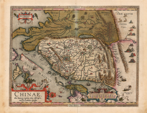
Chinae, olim Sinarum regionis, nova descriptio. auctore Ludovico Georgio.
sold
- Digital Map Information
- Suitable for large format printing
- Full resolution TIFF file
- ICC color profile embedded
- Delivered instantly via download link
This is Abraham Ortelius' 1584 map of China, the first specific map of China to appear in an atlas, here in a beautiful, original-color example of a 1602 Vrients edition. Based on reports of Portuguese missionaries, Ortelius' map was not substantially improved upon until the 1655 maps of Martino Martini (卫匡国; 1614 - 1661). The map is visually unique, with its western orientation and abundant decorative elements. (more details)
First European map specifically of China to appear in a modern atlas.
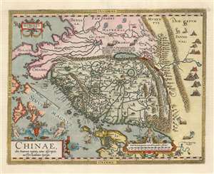
Chinae, olim Sinarum regionis, nova descriptio. auctore Ludovico Georgio.
sold
- Digital Map Information
- Suitable for large format printing
- Full resolution TIFF file
- ICC color profile embedded
- Delivered instantly via download link
This is Abraham Ortelius' 1584 map of China, the first specific map of China to appear in an atlas. Based ultimately on reports of Portuguese missionaries, it would not be substantially improved upon until Martino Martini's (卫匡国; 1614-1661) 1655 maps. The map is visually very distinctive, with its western orientation and abundant decorative elements. (more details)