
Kaliher, Stephen Eugene (sold)

Stephen Eugene Kaliher (1910 - October 19, 1969) was an American military officer, artist, and engineer. A native of Ohio, Kaliher was an engineer and surveyor by profession working as a civil engineer at a steel plant in Ohio in 1940. Kaliher enlisted in the U.S. Army in 1942 and served in the 79th Infantry Division, where he attained the rank of Master Sergeant. After the war, Kaliher founded the engineering firm Kohli and Kaliher Associates, Inc, a firm that he worked with until his death. Kaliher was married to Beata Kaliher with whom he had two children.
The advance of the 79th Division across northern France - including a vignette of the critical crossing of the Seine at Mantes Gassicourt.
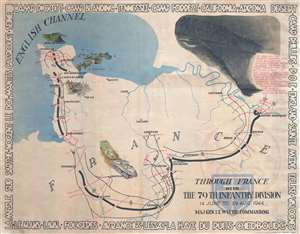
Through France with the 79th Infantry Division 14 June to 29 Aug, 1944. Maj Gen I.T. Wyche, Commanding.
sold
- Digital Map Information
- Suitable for large format printing
- File Size: 18.53 MB
- File Type: ZIP / TIFF
- ICC color profile embedded
- Delivered instantly via download link
This is a 1945 Steve Kaliher and Harry D. White pictorial map of the 79th Infantry's route through northern France. The map depicts northern France from the English Channel south to Le Mans and from Mont Saint-Michel Bay to Mantes Gassicourt and the Seine River. ... (more details)
A complete set of 79th Infantry Division route maps from World War II - maps created by the soldiers for the soldiers.
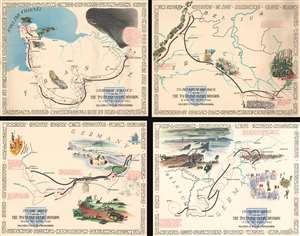
Through France with the 79th Infantry Division 14 June to 29 Aug, 1944. Maj Gen I.T. Wyche, Commanding. / To Belgium and Back wit the 79th Infantry Division 31 Aug to 25 Oct, 1944 Maj. Gen. I. T. Wyche, Commanding. / To the Rhine with the 79th Infantry Division 25 Oct to 14 Feb. 1945 Maj Gen I.T. Wyche, Commanding. / Over the Rhine with the 79th Infantry Division 17 Feb to 9 May 1945 Maj. Gen. I. T. Wyche, Commanding.
sold
- Digital Map Information
- Suitable for large format printing
- File Size: 161.21 MB
- File Type: ZIP / TIFF
- ICC color profile embedded
- Delivered instantly via download link
This is a set of four Steve Kaliher and Harry D. White pictorial World War II route maps of the 79th Infantry's advance from Normandy to Germany. Presented on four separate sheets, a detailed summary of the division's progress across northern Europe from Utah Beach (one of the four Normandy beaches assaulted by Allied troops only eight days on what has become known as D-Day) to Mulheim, Germany. Each map traces a sequence of a few months in the combat history of the 79th with red lines labeled with dates marking the advance week by week and sometimes day to day. Text blocks narrate parts of the advance, providing insight into what the division accomplished during their over 300 days of combat. Cities and towns are identified throughout all four maps, as are rivers. Each map is framed by the names of cities and towns that the division passed through on their advance, fought for, and liberated, adding yet another level of memory to each piece. (more details)