
King, Nicholas (sold)

Nicholas King (1771 - 1812) was an English-born artist, surveyor, and cartographer who played an important role in the early years of the American Republic. Born in Yorkshire to a father who was also a land surveyor, he left for New York in 1793 and soon moved to Philadelphia to take up work as a draughtsman and surveyor. In 1796, he moved to what would become Washington, D.C., where he undertook cadastral surveys of the city (he was a proponent of the original 1791 L'Enfant Plan for Washington, D.C.). In 1801, King was tasked by Albert Gallatin, Secretary of the Treasury, to produce a map of the Northwest Territory. Two years later, Gallatin asked him to produce a 'blank map' of the continent indicating the Mississippi River and Pacific Coast, for use on the Lewis and Clark Expedition. While the expedition was underway, King was dispatched to its winter camp at Fort Mandan to produce a set of maps based on the sketches of William Clark. He likewise produced maps of the southern portion of the Louisiana Territory (portions of present-day Louisiana, Arkansas, and Texas) from sketches of William Dunbar and the Curtis-Freeman Expedition. King was something of a polymath and inventor, and dabbled in politics and manufacturing late in his life.
Earliest detailed mapping of the Ouachita River.
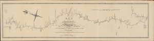
Map of the Washita River in Louisiana from the Hot Springs to the Confluence of the Red River with the Mississippi Laid down from teh Journal and Survey of Wm. Dunbar Esq. in the year 1804 by Nicholas King.
sold
- Digital Map Information
- Suitable for large format printing
- File Size: 392.79 MB
- File Type: ZIP / TIFF
- ICC color profile embedded
- Delivered instantly via download link
A 1904 reprint of a nearly unobtainable 1804 original map of the Ouachita ('Washita') River in Louisiana and Arkansas. It was engraved by Nicholas King based on a survey undertaken by William Dunbar, who led an expedition to explore the southern portion of the Louisiana Territory, similar to Lewis and Clark's more famous expedition further north. (more details)