
Kinneir, Sir John Macdonald (sold)

Sir John Macdonald Kinneir (February 3, 1782 - June 11, 1830) was a Scottish army officer of the East India Company, diplomat and traveller. In 1804 he was appointed ensign in the Madras infantry, and posted in 1807 as lieutenant. He was attached to Sir John Malcolm's mission in Persia between 1808–9, during which time he travelled widely. He produced a Gazetteer of Persia in 1813, which for many years remained the best source of geographical data for that part of the world. In 1824 he was appointed envoy to Fath-Ali Shah Qajar of Persia, for the East India Company, arriving in time for the Russo-Persian War (1826–28).
First 'Great Game' Map.
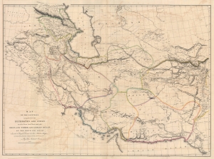
Map of the Countries lying between then Euphrates and Indus on the East and West, and the Oxus and Terek and Indian Ocean on the North and South.
sold
- Digital Map Information
- Suitable for large format printing
- File Size: 91.04 MB
- File Type: ZIP / TIFF
- ICC color profile embedded
- Delivered instantly via download link
This is John Macdonald Kinneir and Aaron Arrowsmith's 1813 large-scale map of Persia and parts of Afghanistan, Iraq, and Pakistan. This was the best obtainable map of Persia and Central Asia available in the leadup to the Great Game (1813 - 1895), and indeed, might be considered the first Great Game Map. It was issued at the end of the Russo-Persian War (1804 - 1813) and coincided with the Treaty of Gulistan, which opened up Persia for Russian invasion and set the stage for decades of Anglo-Russian conflict. (more details)
The Best Large-Scale Atlas Map of Afghanistan Prior to the Anglo-Afghan War
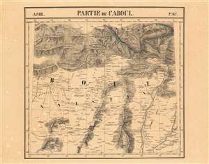
Partie du Caboul Asie no.67.
sold
- Digital Map Information
- Suitable for large format printing
- DPI: 600
- File Size: 30.9 MB
- File Type: ZIP / TIFF
- ICC color profile embedded
- Delivered instantly via download link
This is the 1827 Vandermaelen map of the Afghanistan, Pakistan and the Hindu Kush. It is the first large-scale atlas map to focus on the area, and the first to be executed in lithography. The map's detail - drawn from the first-hand exploration of John Macdonald Kinneir on behalf of the British East India Company - would not be improved upon until the First Anglo-Afghan War. (more details)