
Kirkwood, Robert (sold)

Robert Kirkwood (December 8, 1774 – November 14, 1818) was a Scottish engraver active in Edinburgh during the late 18th and early 19th century. He is the scion of the important Scottish Kirkwood family, who produced a number of great engravers. His father was James Kirkwood, another well-known Edinburgh engraver, and probably the man who trained him in the engraver's art. Initially he patterned with his father and they published under the imprint of 'Kirkwood and Son,' but after about 1814 to his death, he published under his own name. Around 1803 Kirkwood invented and patented a modification to the standard printing press that increased printing speeds. He died at his home, 3 Arniston Place, in Edinburgh. He was survived by his son, also Robert Kirkwood (1798 – 1843) who continued the family engraving enterprise.
Center of the Lesser Antilles.
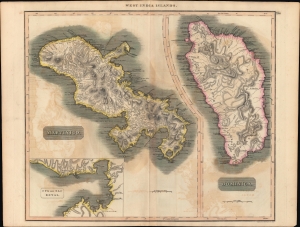
West India Islands. / Martinico. / Dominica. / Cul de Sac Royal.
sold
- Digital Map Information
- Suitable for large format printing
- Full resolution TIFF file
- ICC color profile embedded
- Delivered instantly via download link
A fine example of John Thomson's stunning c. 1814 hand-colored map of the West India islands of Dominica and Martinique, engraved by Kirkwood and Son for the 1817 edition of Thomson's General Atlas. (more details)
Rare and beautiful map illustrating Napoleon's last place of Exile.
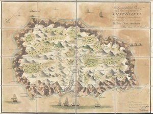
The Geographical Plan of the Island and Forts of Saint Helena is dedicated by permission to Field Marshal His R. Highness The Duke of Kent and Strathearn.
sold
- Digital Map Information
- Suitable for large format printing
- DPI: 300
- File Size: 8.78 MB
- File Type: ZIP / TIFF
- ICC color profile embedded
- Delivered instantly via download link
A remarkable 1815 map of the Island of Saint Helena, the fallen Emperor Napoleon Buonaparte's final place of exile, by Robert P. Read. After his June 18, 1815 defeat at the Battle of Waterloo, Napoleon sought asylum from the British who promptly exiled him to the ... (more details)
Attractive map of Guaeloupe - a French Caribbean paradise.
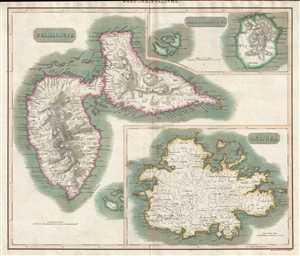
West India Islands. Guadaloupe. Antigua. Mariegalante etc.
sold
- Digital Map Information
- Suitable for large format printing
- DPI: 300
- File Size: 13.13 MB
- File Type: ZIP / TIFF
- ICC color profile embedded
- Delivered instantly via download link
This is an 1815 John Thomson map of Guadeloupe, Antigua, and Marie-Galante in the West Indies. Each island is depicted as an inset, with each inset focusing on one island. All three islands are illustrated in detail, with numerous coastal locations, towns, ... (more details)