
Kraatz, Leopold (sold)

Leopold Kraatz (18xx - 19xx) was a German lithographer, engraver, and printer active in Berlin Germany during the late 19th and early 20th centuries. Kraatz worked with Lange in 1854 and Kiepert from 1860 until 1888.
Best 19th century general map of the Ottoman Empire.
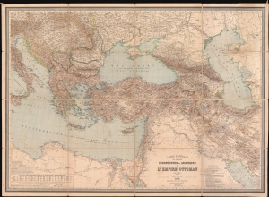
Carte Générale des Provinces Européennes et Asiatiques de l'Empire Ottoman (sans l'Arabie).
sold
- Digital Map Information
- Suitable for large format printing
- File Size: 150.63 MB
- File Type: ZIP / TIFF
- ICC color profile embedded
- Delivered instantly via download link
This is an 1892 Heinrich Kiepert wall map of the Ottoman Empire. The work of Europe's finest cartographer, this is without question the best large scale general map of the Ottoman dominions to appear in the 19th century. (more details)