
Kraetzer, Ludwig Gustav Adolph (sold)

Ludwig Gustav Adolph Kraetzer (March 21, 1822 - October 21, 1901), generally publishing as Gustav Kraetzer, was a German-American lithographer and printer based in New York. Kraetzer was born in Mainz, Rheinland-Pfalz, Germany. He was involved with the Revolutions of 1848 and following the suppression was forced to flee Germany. He arrived in the United States, coming through New York, in October of 1850 on the ship William Tell. He became a U.S. citizen several years later in 1856. When Kraetzer arrived in New York it has already a master lithographer, having trained in Germany. His printing concern was widely published and includes decorative prints, views, business products, advertising, and maps. Kraetzer maintained offices on Sheffield Avenue in East New York, Long Island, now part of Brooklyn.
From farmland to professional suburb.
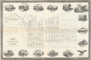
Map of East New York Kings County Long-Island NY.
sold
- Digital Map Information
- Suitable for large format printing
- File Size: 888.7 MB
- File Type: ZIP / TIFF
- ICC color profile embedded
- Delivered instantly via download link
This is the only known surviving example of an 1859 real-estate promotional map for East New York, Brooklyn, published by Charles W. Heitkamp. The map, printed and published by residents, captures the moment of East New York's transition from an agricultural community on the outskirts of Brooklyn to a German-American suburb well connected to major public transportation arteries. (more details)
The first official map of Guatemala! A cornoerstone piece for Central American 'Decolonization'!
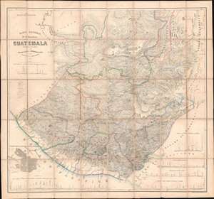
Mapa General de la Republic de Guatemala.
sold
- Digital Map Information
- Suitable for large format printing
- File Size: 79.73 MB
- File Type: ZIP / TIFF
- ICC color profile embedded
- Delivered instantly via download link
A seminal production, this 1959 map by Maximilian von Sonnenstern and August van de Gehüchte is the first official map of Guatemala and a key document associated with Guatemalan independence. The map was commissioned by first president of Guatemala, Rafael Carrera Turcios (1814 - 1865), and is the first broadly accurate meticulously detailed map of that country. The enduring legacy of this map includes its role in establishing and legitimizing Guatemala, as well as its significant evidentiary rule in subsequent Guatemalan boundary disputes and negotiations. In addition, this is the first to accurately map Guatemala's many important Mayan ruins. (more details)