
Lacouchy, P. (sold)

P. Lacouchy (18xx - 18x) was a French copper and steel-plate engraver active Paris during the middle part of the 19th century.
Sailing to Australia for the Victoria Gold Rush!
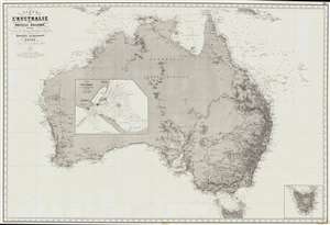
Carte de L'Australie ou Nouvelle Hollande, dressée d'aprés les derniers documents Anglais part Robiquet, Hydrographe, Paris.
sold
- Digital Map Information
- Suitable for large format printing
- File Size: 88.54 MB
- File Type: ZIP / TIFF
- ICC color profile embedded
- Delivered instantly via download link
A fine and exquisitely detailed 1863 first edition of Aimé Robiquet's privately published nautical chart or maritime map of Australia. Covering all of Australia, with Tasmania represented as an inset, this map was published to capitalize on navigation to Melbourne associated with the Victoria Gold Rush - hence the large inset of Port Phillip, the access point to Melbourne and the wealth lying just inland. Robiquet compiled this chart from the most up-to-date English sources, with several modifications and additions of his own to increase accuracy. (more details)