
Lahontan, Louis Armand Baron de (sold)

Louis Armand Baron de Lahontan (June, 9 1666 – 1715) was a French nobleman and military officer best known for his extensive, and quite possibly fictional, travels in the Wisconsin and Minnesota region and the upper Mississippi Valley. Lahontan became the Baron Lahontan upon his father's death in 1674. Around 1683, at around 17, he joined the Troupes de la Marine and was sent to New France or Canada. After leading several failed military campaigns against English and Iroquois fortifications around the Great Lakes, Lahontan and his troops integrated with the local Algonquin Indians with whom they lived for several years. During this time he, supposedly, spent much of his time exploring the region, including a supposed expedition on a river he referred to as the "Rivière Longue". Though many consider his tale fanciful, he claims to have followed the river for a reasonable distance to a mountain range. Beyond the mountains, he was told by his American Indian guides, lay another river that flows westward and has an outlet into a salt sea. There are many debates regarding this, some consider it an early reference to the Missouri - Columbia River network later explored by Louis and Clark. Others believe he stumbled upon an early description of the Great Salt Lake. Regardless, his narrative which was published in Europe proved enormously popular and encouraged a number of attempts to search of the Longue River, which it was assumed, was part of a river network extending to the Pacific. The River and other aspects of Lahontan's cartography found its way into numerous influential maps of the period before being ultimately abandoned in the late 18th century.
Rare first edition of Lahontan's highly influential map of the supposedly apocryphal Riviere Longue (Missouri River?)
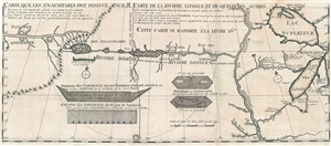
Carte que les Gnacsitares ont Dessine sur / Carte de la Riviere Longue et de quelques Autres qui se Dechargent dans le Grand Fleuve Missisipi.
sold
- Digital Map Information
- Suitable for large format printing
- DPI: 300
- File Size: 8.32 MB
- File Type: ZIP / TIFF
- ICC color profile embedded
- Delivered instantly via download link
A foundational map of extreme importance and influence, this is the rare 1703 first edition of Baron Louis-Armand de Lom d'Arce de Lahontan's, seminal map of the westernmost Great Lakes, the Mississippi River, and an enigmatic tributary river, the Riviere Longue or ... (more details)
Rare first edition of Lahontan's highly influential map of the supposedly apocryphal Riviere Longue (Missouri River?)
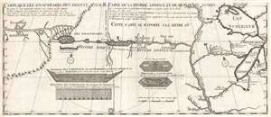
Carte que les Gnacsitares ont Dessine sur / Carte de la Riviere Longue et de quelques Autres qui se Dechargent dans le Grand Fleuve Missisipi.
sold
- Digital Map Information
- Suitable for large format printing
- DPI: 300
- File Size: 7.06 MB
- File Type: ZIP / TIFF
- ICC color profile embedded
- Delivered instantly via download link
A foundational map of extreme importance and influence, this is the rare 1703 first edition of Baron Louis-Armand de Lom d'Arce de Lahontan's, seminal map of the westernmost Great Lakes, the Mississippi River, and an enigmatic tributary river, the Riviere Longue or ... (more details)
Foundational Map of the Transmississippi.
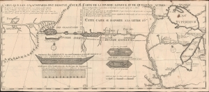
Carte que les Gnacsitares ont Dessine sur / Carte de la Riviere Longue et de quelques Autres qui se Dechargent dans le Grand Fleuve Missisipi.
sold
- Digital Map Information
- Suitable for large format printing
- File Size: 14.91 MB
- File Type: ZIP / TIFF
- ICC color profile embedded
- Delivered instantly via download link
A foundational and influential map, this is the 1703 first edition of Baron Louis-Armand de Lom d'Arce de Lahontan's seminal map of the westernmost Great Lakes, the Mississippi River, and its enigmatic tributary river, the Riviere Longue or Long River, extending westwards towards the Rocky Mountains. Although Baron de Lahontan's cartography has been severely criticized and considered apocryphal by some, it exerted a profound influence on other mapmakers of the era, including Herman Moll, John Senex, Henry Popple, and Guillaume Delisle. (more details)
This primary map of Canada emphasized the importance of the river trading routes.' -Kershaw
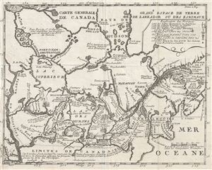
Carte Generale de Canada.
sold
- Digital Map Information
- Suitable for large format printing
- Full resolution TIFF file
- ICC color profile embedded
- Delivered instantly via download link
A fine example of Lahontan's scarce and important 1715 map of the Great Lakes, Canada, and the Upper Mississippi. Lahontan's map covers from the Mississippi River eastward to the mouth of the St. Lawrence and the Atlantic Ocean, and from the Hudson Bay to the ... (more details)