
Langevin (sold)

Langevin (fl. c. 1820 - 1860) was a French engraver active in Paris during the mid-19th century. Little is known about this figure despite copious works bearing his imprint. In some maps dating to the 1850s, he described himself as the successor to 'Bénard', possibly referring to Robert Bénard (1734 - c. 1785) or one of his descendants. Langevin engraved extensively for Alexandre Aimé Vuillemin (1812 - 1880) and Charles Fatout (18?? - 1882).
Striking map capturing the sprit of the mid-19th century.
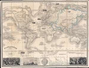
Planisphère Illustré présentant la description géographique des parties connues de la Terre indiquant l'époque des grandes decouvertes et le nom des navigateurs, les Coloniess des Diverses Nations ainsi que le percours des bateaux à vapeur, l'époque des départs, la durée du trajet, et c.
sold
- Digital Map Information
- Suitable for large format printing
- Full resolution TIFF file
- ICC color profile embedded
- Delivered instantly via download link
A striking 1850 Alexandre Vuillemin map of the world, here in its first edition, capturing the social, economic, and scientific ethos of the mid-19th century. Centered on the Bight of Benin, Vuillemin's dissected folding map covers the entire world on a Mercator Projection. The map's magnificent size allows for stupendous detail throughout and accommodates copious annotations, some of which are fascinating. Nine large vignettes illustrate dramatic scenes ranging from whaling in the Arctic and Antarctic, to jousting at ostriches in Africa. Major maritime routes are illustrated, with distances. Also, in the Arctic and Antarctic, ice flows are illustrated pictorially to high dramatic effect. Some annotations of exceptional interest including a note on the California Gold Rush (still of great interest in 1850), the cod fisheries on the Grand Banks, and the discovery of Lyakhov's ivory islands (New Siberia). In the lower quadrants statistical charts illustrate comparative mountain heights and river lengths. To either side, ethnographic charts illustrate the traditional dress of diverse peoples. (more details)
A comprehensive global guide.
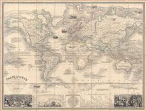
Planisphère illustré présentant la description géographique des parties connues de la terre...
sold
- Digital Map Information
- Suitable for large format printing
- DPI: 600
- File Size: 280.16 MB
- File Type: ZIP / TIFF
- ICC color profile embedded
- Delivered instantly via download link
This is a scarce and beautifully engraved 1853 'planisphere' world map by Alexandre Vuillemin and Langevin. It illustrates known global geography along with vignettes and explanatory notes on the history of navigation, natural resources, and the cultures of various parts of the world. (more details)