
Lederer, John (sold)

John Lederer (1644 - c.1671) was a German born explorer and physician who was one of the first Europeans to explore the western parts of Virginia and Carolina. Born in Hamburg, Germany, Lederer is a rather elusive figure until he appears in Jamestown, Virginia around 1668. The Governor of Virginia was then William Berkeley who believed that the wealth of his colony would be greatly increased if he could find a passage over the Allegheny Mountains to the Pacific - which he believe to be only a few weeks distant. Lederer was the first to take up the commission to explore these lands. The three subsequent voyages make by Lederer from 1669 to 1670 were both controversial and extraordinary influential. While we will not recount Lederer's voyages in detail here, will say that he was the first European to attempt and accurate mapping of the interior of Virginia and Carolina. Lederer was also most likely the first European to see the Shenandoah valley, and the Blue Ridge Mountains. Some of Lederer's more fantastic claims suggest that he discovered a large savanna in the Carolina-Virginia piedmont, that he crossed a great desert in central Carolina, and that he drank from the mythical Lactus Aquae Dulche. Scholars have argued the merits of Lederer's exploration almost from the first instant of his return, some claiming that his claims were false and others suggesting that they true but represent misunderstandings on his part and on the part of his readers. Our own reading of Lederer's narrative argues for the later and for the relative veracity of his claims. Upon returning from this third expedition Lederer found himself deeply in debt and "he was look'd on as so great an insolence, that our traveller at his return, instead of welcome and applause, met nothing but affronts and reproaches". This most likely resulted from an enimenity developed on with one of his traveling companions on the second expedition, one Major Harris. Lederer and Harris traveled together from the Falls of the James River westward to a point where the James River turned creating a wide lake-like passage. Harris declared that he had discovered a southern extension of the "Lake of Canada" and returned to Jamestown to bask in the admiration of his fellow colonists. Lederer however continued, discovering the truth of Harris's "Discovery" and went on to make what would seem to be pretty major discoveries himself. Harris, a popular Englishman, was no doubt humiliated and dishonored at Lederer's return. Lederer, being a German was an easy target for the predominantly English colonists and later left for Maryland where he was welcomed by Governor Charles Clavert. Calvert issued Lederer a patent to trade furs with Indians outside the colonial borders of Maryland. In 1671 Lederer was naturalized as a citizen of Maryland and gave up his German nationality. There he also befriended William Talbot, nephew of Lord Baltimore, who aided him in the publication of his travel narrative "The Discoveries of John Lederer, etc.." in 1672. Lederer's description of Carolina and his map had a significant impact on the cartography of Carolina for the next hundred years. It is uncertain when and where Lederer died.
One of the first renderings of the Carolina colony's interior.
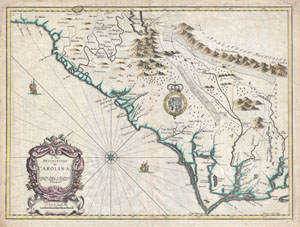
A New Description of Carolina.
sold
- Digital Map Information
- Suitable for large format printing
- Full resolution TIFF file
- ICC color profile embedded
- Delivered instantly via download link
A beautiful example of John Speed's important 1676 map of the Carolina colony. Heavily based upon the explorations of John Lederer and Ogilby's Lords Proprietor's Map of 1674. This seminal map represents one of the earliest attempts to map the Carolina interior. ... (more details)
A ground-breaking map of Carolina showing the contentions geography of Jonathan Lederer.
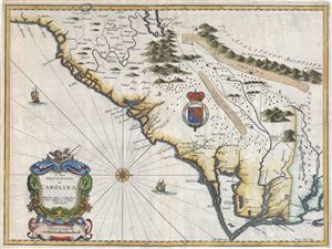
A New Description of Carolina.
sold
- Digital Map Information
- Suitable for large format printing
- Full resolution TIFF file
- ICC color profile embedded
- Delivered instantly via download link
A very attractive example of John Speed's important and rare 1676 map of the Carolina colony - representing the first serious attempts to map the interior of the Carolinas based upon actual exploration. Speed heavily based his cartography of Carolina upon the explorations of John Lederer and Ogilby's Lords Proprietor's Map of 1674. Oriented to the West, map covers from the Spanish colony of St. Augustine, Florida, north to the English colony of Jamestown, Virginia. It extends inland as far as the Appalachian (Apalathean) Mountains. (more details)
Essential Map for the Carolina Collector.
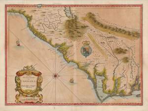
A New Description of Carolina.
sold
- Digital Map Information
- Suitable for large format printing
- Full resolution TIFF file
- ICC color profile embedded
- Delivered instantly via download link
A striking example of the important and scarce map of the Carolina colony engraved by Francis Lamb in 1676, for inclusion in John Speed's atlas. It is one of the earliest early English maps specifically of the colony acquirable by the collector, published just six years after the founding of Charleston. As such, it is a map of seminal importance, and an essential document in the history of the Carolinas specifically, and the British settlements in North America in general. (more details)