
Leiser, Jr., Theodore (sold)

Theodore Leiser, Jr. (1942 - present) is an American artist currently living in Alabama.
Identifies schools, municipal buildings, and other sites around Key West and provides a short history of the island.
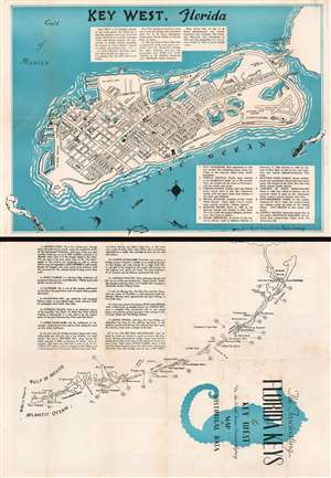
The Fascinating Florida Keys and Key West Via the World Famous Overseas Highway Map and Historical Data.
sold
- Digital Map Information
- Suitable for large format printing
- File Size: 22.66 MB
- File Type: ZIP / TIFF
- ICC color profile embedded
- Delivered instantly via download link
This is a c. 1957 Theodore Leiser, Jr. city map or plan of Key West, Florida. The map depicts the entirety of Key West from Fort Taylor to Stock Island and from the Gulf of Mexico to the Atlantic Ocean. Streets throughout the city are illustrated and labeled, with schools, city happ, the post office, and the West Martello Tower Art Gallery illustrated as well. The U.S. naval base and the navy barracks are identified, as is Meacham Field Airport. The Overseas Highway is labeled along with the naval hospital and the Key West Yacht Club. A short narrative history of Key West is included above the island, while an index of ten locations is situated in the lower right corner and provides short descriptions of these ten sites. A map of the Florida Keys is illustrated on the verso. Each key is labeled and an index in the upper left quadrant provides a sentence or two of information about each one. (more details)