
Locher, Felix Maurice (sold)
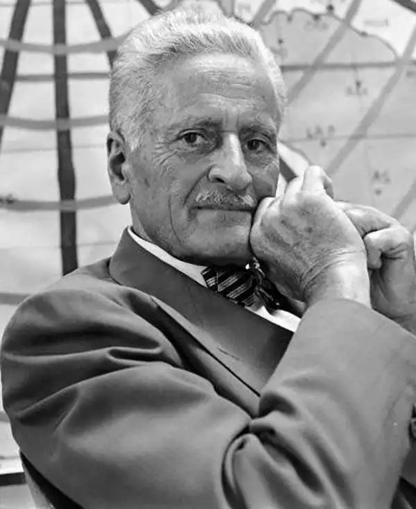
Felix Maurice Locher (July 16, 1882 - March 13, 1969) was a Swiss inventor and actor. Born in Bern, Switzerland, Locher held over 100 copyrights and patents, all relating to a unique mapping system. Locher began working as an actor at the age of 73, when he was visiting his son, actor Jon Hall (February 23, 1915 - December 13, 1979), on a movie set. The director of the movie, Elmo Williams, convinced Locher to play the elderly Tahitian chef in the film. From there he went on to have a productive acting career, and even appeared in Star Trek. He bears the distinction of being the oldest actor ever to appear in an episode of Star Trek by birth year. Little is known about Locher's personal life.
A revolutionary map incorporating Great Circle routes and distances traveled.
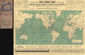
Locher-Hall Tele-Curve Map for Air-Aige. Shortest Airline Courses and Great Circle Distances.
sold
- Digital Map Information
- Suitable for large format printing
- File Size: 13.43 MB
- File Type: ZIP / TIFF
- ICC color profile embedded
- Delivered instantly via download link
This is a 1944 Locher-Hall Telecurve map of the world. Invented by the father-son duo of Felix Locher and Jon Hall, the map depicts the world with the Americas at the center and Europe, Africa, and western Asia on the right and eastern Asia and Australia on the left. Utilizing the concept of Great Circle Routes (the shortest distance between two points on the globe), Locher and Hall integrated these new air routes with curves measuring the distances traveled. This allows viewers of their map to not only see the Great Circle Route from a certain starting point (here it is the New York City area, there were multiple different editions with different starting points), but to be able to gauge the distance traveled along one of these routes as well. Countries throughout the world are labeled and myriad cities are identified, most by two or three letter abbreviations. Locher and Hall also include time zones in an effort to help people understand how time progresses across the world. In that effort, a detachable 'time band' is printed along the bottom, meaning that, if one wanted to, they could cut it off the bottom and use it to find out what time it was in a certain city relative to where they were. Other helpful resources, including two distance conversion tables, are situated along the top border. (more details)