
Magnus, Olaus (sold)

Olaus Magnus (October 1490 - August 1, 1557), whose name is Latinized from Månsson, was a Swedish writer and Catholic canon and archdeacon. A mission to secure an archbishopric for his brother Johannes led him to travel to Rome in 1524, and thereafter he remained broad engaged in diplomacy until the victory of the reformation in Sweden exiled him permanently, first to Poland and then to Rome in 1537. Magnus' contributions to geography are his 1539 map Carta marina et Descriptio septemtrionalium terrarum and his 1555 Historia de Gentibus Septentrionalibus (a collection of folklore and history which for a century remained the European authority on Sweden, its people and its climate.) Carta Marina, a 9-sheet woodcut map surviving in but two known copies, was deeply influential, providing the dominant model for the mapping of the northern parts of Europe prior to Ortelius. The map has withstood scrutiny even to this day in some respects. Modern oceanographers have analyzed Magnus' work and found his descriptions of currents between Iceland and the Faroe islands to be accurate.
Scarce, early, Scandinavia.
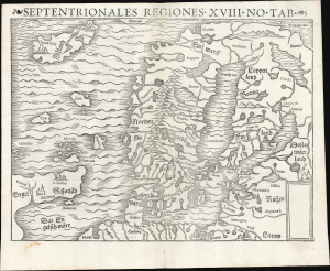
Septentrionales Regiones. XVIII. No. Tab.
sold
- Digital Map Information
- Suitable for large format printing
- Full resolution TIFF file
- ICC color profile embedded
- Delivered instantly via download link
This is Sebastian Münster's scarce woodcut map of Scandinavia and the northern parts of the European world, first added to his Cosmographia in 1544; this example is of its second, 1545 printing. It is one of the few examples of this map printed during its author's lifetime. It is an important work, being the earliest acquirable derivative of the 1539 milestone Olaus Magnus Carta Marina, then the most correct and detailed depiction of Scandinavia. The present work is, moreover, one of the scarcest of Münster's maps. Of more than 30 editions of Cosmographia, this map only appeared in nine, and in only two editions of his Ptolemy. (more details)
First Map of Iceland to Improve on Olaus Magnus
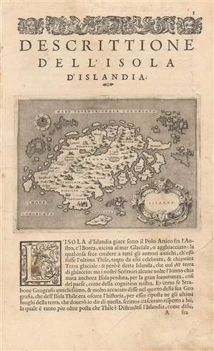
Islanda.
sold
- Digital Map Information
- Suitable for large format printing
- Full resolution TIFF file
- ICC color profile embedded
- Delivered instantly via download link
Tommaso Porcacchi's 1572 map of Iceland, in a beautiful early issue with a bold, sharp strike. It is the first separate map of Iceland to improve upon the cartography handed down from the venerable 1539 Olaus Magnus Carta Marina, whose Iceland data was reproduced by several mapmakers of the La Freri school without improvement. This map - elegantly engraved by Girolamo Porro for Porcacchi's isolario - starts with the Iceland of Magnus' Carta Marina but corrects the locations of many features. For example, the see of Hólar (Holensis) has been moved to its right place in the north, and Skálholt (Scalholdin) is correctly located in the south. Both of these locations were important in recent Icelandic history: Hólar had been the see of Jón Arason, the last Catholic bishop of Iceland. During the Reformation, it was to Skálholt that Arason and his two sons were taken and beheaded. Not all of Porcacchi's additions were well-advised; a few items have been taken from the wildly inventive Zeno map, including the seven islands appearing off the east coast. (more details)
One of the Earliest Separate Maps of Iceland.
Islanda.
sold
- Digital Map Information
- Suitable for large format printing
- DPI: 600
- File Size: 4.98 MB
- File Type: ZIP / TIFF
- ICC color profile embedded
- Delivered instantly via download link
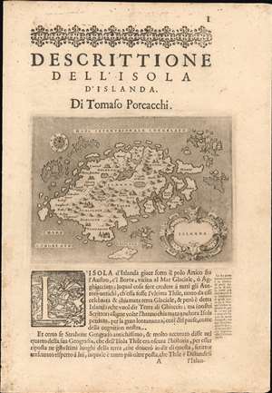
Tommaso Porcacchi's 1572 map of Iceland, in a beautiful early issue with a bold, sharp strike. It is the first separate map of Iceland to improve upon the cartography handed down from the venerable 1539 Olaus Magnus Carta Marina, whose Iceland data was reproduced by several mapmakers of the La Freri school without improvement. This map - elegantly engraved by Girolamo Porro for Porcacchi's isolario - starts with the Iceland of Magnus' Carta Marina but corrects the locations of many features. For example, the see of Hólar (Holensis) has been moved to its right place in the north, and Skálholt (Scalholdin) is correctly located in the south. Both of these locations were important in recent Icelandic history: Hólar had been the see of Jón Arason, the last Catholic bishop of Iceland. During the Reformation, it was to Skálholt that Arason and his two sons were taken and beheaded. Not all of Porcacchi's additions were well-advised; a few items have been taken from the wildly inventive Zeno map, including the seven islands appearing off the east coast. (more details)