
Michault, René (sold)

René Michault (fl. 1668 - c. 1685) was a French copperplate engraver and calligrapher active in Paris in the second part of the 17th century. He is considered one of the best pupils of the great calligraphic master Nicolas Jarré. His work appears on the maps of Sanson, De Fer, Du Val, and Justel.
First Acquirable Map of the British Colonies from Virginia to New England.
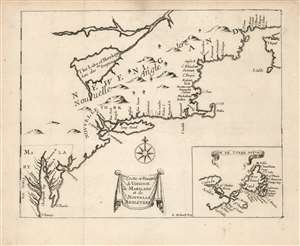
Costes et Rivieres de Virginie de Mariland et de Nouvelle Angletere.
sold
- Digital Map Information
- Suitable for large format printing
- Full resolution TIFF file
- ICC color profile embedded
- Delivered instantly via download link
This is the 1674 Justel edition of Richard Blome's map of Virginia, Maryland, and New England. Blome's rare 1672 A Draught of the Sea Coast and Rivers of Virginia, Maryland and New England Taken from the latest Surveys was the first English map to focus on the British colonies in North America from Virginia up through New England, just preceding the explosion of geographical knowledge represented by the works of Herrman (1673) and Seller (1676.) This French edition of the map is also scarce, but more acquirable to the collector than the Blome. It is a valuable addition to any collection pertaining to colonial Virginia and New England, in that it shows the starting point for the expansion of those colonies that followed in the late seventeenth century. (more details)
First Acquirable Map of the British Colonies from Virginia to New England.
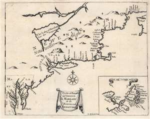
Costes et Rivieres de Virginie de Mariland et de Nouvelle Angletere.
sold
- Digital Map Information
- Suitable for large format printing
- Full resolution TIFF file
- ICC color profile embedded
- Delivered instantly via download link
This is the 1674 Justel edition of Richard Blome's map of Virginia, Maryland, and New England. Blome's rare 1672 edition of this work was the first English map to focus on the British colonies in North America, Virginia up through New England; it just preceded the explosion of geographical knowledge represented by the works of Herrman (1673) and Seller (1676.) This French edition of the map is also scarce, but more acquirable to the collector than the Blome, and is a faithful copy of its precursor. It is a valuable addition to any collection pertaining to colonial Virginia and New England, in that it depicts the starting point for the expansion of those colonies that followed in the late seventeenth century. (more details)