
Mining and Industrial Publications of Africa, Ltd.
British Commerical Interests in Portuguese East Africa.
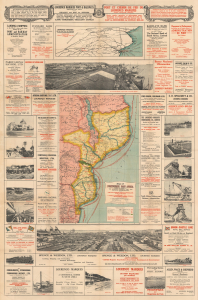
Map of Portuguese East Africa Published and presented by the Lourenço Marques Port and Railways Administration.
$3,000.00
Acquire
- Digital Map Information
- Suitable for large format printing
- Full resolution TIFF file
- ICC color profile embedded
- Delivered instantly via download link
This large (60 x 39.75 in) 1931 advertising wall map of Portuguese East Africa was issued by the Lourenço Marques Port and Railways Administration to promote Mozambique's capital as a maritime gateway to southern Africa's industrial interior. The British firm Mining and Industrial Publications of Africa published the map, and its copious advertisements for British firms underscore Portugal's limited ability to realize its ambitions for Lourenço Marques (now Maputo) and the dependence of the region on British commercial services. (more details)