
Mullan, John (sold)
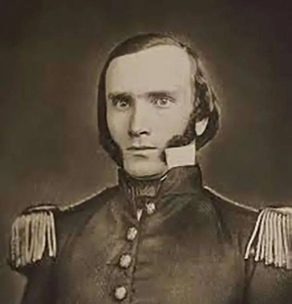
John Mullan (July 31, 1830 - December 28, 1909) was an American soldier, explorer, civil servant, and road builder. He was born in Norfolk, Virginia, and at the early age of 16 earned his B.A. at St. John's College in Annapolis. He would go on to attend West Point in 1852, focusing his studies on engineering, mathematics, and science.[11] West Point was then the nation's preeminent engineering school, and learning to navigate using a compass and odometer. He graduated to a commission as a Second Lieutenant in the United States Army in 1852 and was assigned to the 1st Artillery Regiment in San Francisco. From there, he would join Isaac Stevens' Northern Pacific Railroad Survey. As part of his work for the survey he explored western Montana, southeastern Idaho, discovered and named Mullan Pass, participated in the Yakima War, and led the construction crew which built the Mullan Road in Montana, Idaho, and Washington state between the spring of 1859 and summer of 1860. He wrote Report on the Construction of a Military Road from Fort Walla Walla to Fort Benton (1863), and Travellers' Guide to Oregon, Washington, Idaho, Montana, Wyoming, and Colorado, via the Missouri and Columbia Rivers (1865).
Scarce, Superbly Detailed Map of the Northwestern Territories and States: First Detailed Map Naming the Wyoming Terrirory
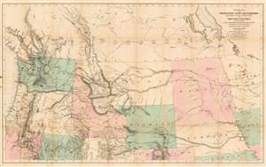
General Map of the North Pacific States and Territories Belonging to the United States and of British Columbia, Extending from Lake Superior to the Pacific Ocean and Between Latitude 39 degrees and 53 degrees North. Exhibiting Mail Routes, Gold Mines, and Including the Most Recent Surveys of the Topographical Bureau. Prepared by Captain John Mullan. ... Drawn by Edward Freyhold, T.E. Lithographed by J. Bien, 24 Vesey, St. N.Y.
sold
- Digital Map Information
- Suitable for large format printing
- File Size: 44.63 MB
- File Type: ZIP / TIFF
- ICC color profile embedded
- Delivered instantly via download link
This the 1865 Mullan - Freyhold map of the American Northwest. It shows the territories of Washington, Idaho, Montana, Wyoming, Dakota and Nebraska, and the State of Oregon in completion, and portions of California, Minnesota, Iowa, Kansas, Colorado, Utah and Nevada. The lithographed map - with hand wash color to distinguish the territories from one another - is beautifully executed and detailed. Carl Wheat esteemed this 'very fine' map so well that he chose it for the frontispiece of the fifth volume of Mapping the Transmississippi West. In discussing Freyhold, in particular, Wheat rhapsodizes:
Edwin (sic) Freyhold, who seems to have been responsible for the actual drawing of the topography, was an unrivaled expert in this type of work. His penned originals are almost unbelievably delicate, and must be examined with a powerful magnifying glass to be appreciated.Indeed, the map's details are superbly drafted and lithographed, with clear, legible typography and beautifully hachured mountains. The map, and the guide accompanying it, was intended to aid and encourage hopeful emigrants to the new territories of the northwest, particularly prospectors. The map relies heavily on data arising from Mullan's tenure as superintendent of construction for the northern military wagon road running from Walla Walla to Fort Benton on the upper Milk River, and indeed Wheat specifically praises the detail of its trails: Mullan's road is shown in its several variants, including Mullan' proposed (and rejected) route to Walla-Walla via Fort Laramie. Another route following the Yellowstone River west and crossing the mountains via Beaver Head Valley is indicated to the south of the Mullan road. Well-established U.S. Mail routes are shown in the southern part of the map. (more details)