
Muntaner, Lorenzo María (sold)

Lorenzo María Muntaner (1782 - 1848) was a Mallorcan engraver based in Palma de Mallorca. His grandfather Lorenzo Muntaner, (1747 - 1768), and father José Mariano Muntaner y Moner (c. 1745 - 1788), were also an engravers and artists.
Extraordinary and rare map of Mallorca with decorative borders.
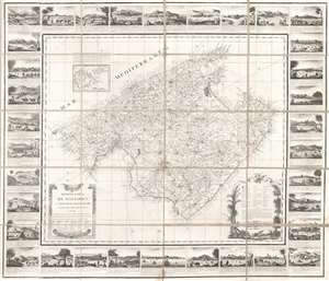
Mapa de la Isla de Mallorca sacado en escala menor del que publico el E.S. Cardenal Despuig El Año 1785.
sold
- Digital Map Information
- Suitable for large format printing
- DPI: 600
- File Size: 40.81 MB
- File Type: ZIP / TIFF
- ICC color profile embedded
- Delivered instantly via download link
An exceptionally rare 1814 / 1829 separately issued broadside map of Majorca (Mallorca), Spain, with fully illustrated surround. The map covers all of Mallorca with an inset illustrating the nearby islands of Cabrera and Conejara. It is based upon an earlier 1785 map surveyed at the order of Cardinal Antonio Despuig y Dameto. Manuel Briton, the island's Artillery Commissioner, partnered with Lorenzo María Muntaner (1782 - 1848), son of the original engraver, to revise the map for sale to tourists in 1814. The map is in Spanish, as are the caption on the surrounding views, but the imprint of Briton and Muntaner is in Catalan. The base map is quite rare and beautiful, but what makes this example special is the decorative surround featuring 34 captioned views of Majorcan towns and villages. (more details)