
Sekisui Nagakubo (sold)
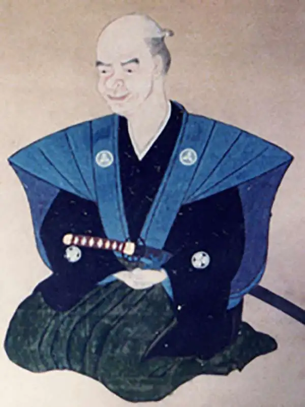
Nagakubo Sekisui (長久保赤水; December 8, 1717 – August 31, 1801), also known as Nagakubo Harutaka (長久保玄珠), was a Japanese cartographer, Confucian scholar, and sinologist active in late 18th century Edo Japan. Sekisui is considered by some to be the 'Founder of Japanese Geography.' He was born in Akahama village, Hitachi Province, and studied medicine under Suzuki Matuse and Nagoe Nankei. In 1767, he accompanied a delegation from nearby Ishohara village to Nagasaki where, being recognized for his scholarship, was elevated to Samurai status. In Nagasaki he was particularly impressed with his experience of the Dutch and Chinese, for whom he developed great respect. Continuing his travels throughout japan, Sekisui encountered his first foreign maps in Osaka and began remaking Japanese maps using foreign technological advancements. His first map, for example, Kaisei Nihon Yochi Rotei Zenzu (Revised Japan World Distances Map), published in 1779, is the first Japanese map to incorporate a geographical coordinate system. He also issued a world map, Sankai yochi zenzu.(Revised Picture of the 10,000 Nations of the World) based upon the Chinese 1602 Matteo Ricci Map. In 1769 Sekisui became the tutor to the daimyô of Mito Han. He retired in 1791. Sekisui's mapmaking work predates the work of the other legendary Japanese cartographer, Ino Tadataka by some 45 years.
Enormous map of China identifying roads and bridges. Shows early Chinese claim to Senkaku / Diaoyu Islands .
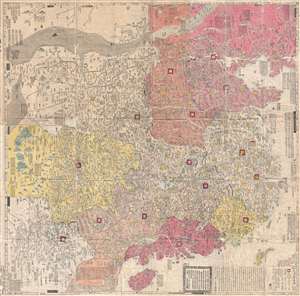
大淸廣輿圖 : 經天合地 : 境域 / Dai Shin kōyozu : keiten gōchi : nikyō jūshishō shii kyōiki. / Enlarged Terrestrial Map of the Great Qing: The Two Capitals, 14 Provinces, and 4 Provinces.
sold
- Digital Map Information
- Suitable for large format printing
- Full resolution TIFF file
- ICC color profile embedded
- Delivered instantly via download link
A rare and important Tenmei 5, Qianlong 50 or 1785 woodblock map of Qing Dynasty China printed in woodblock. This enormous Chinese language map covers from the Tibet and the Kunlun Mountains in western China to Taiwan and the East China Sea, and from Manchuria to ... (more details)
One of the Most Influential Maps of the Tokugawa.
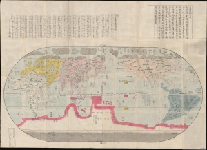
改正地球萬國全圖 / [Revised Map of the Myriad Countries of the World].
sold
- Digital Map Information
- Suitable for large format printing
- Full resolution TIFF file
- ICC color profile embedded
- Delivered instantly via download link
A stunning and influential work, possibly in its earliest edition, this large c. 1790 Japanese world map was issued by Nagakubo Sekisui, the premier Japanese geographer of the late 18th century. It is Nagakubo's interpretation of the 1602 'Matteo Ricci Map', the first map to integrate East Asian and European cartographic knowledge. It includes significant updates over the Ricci, most notably the addition of Australia and islands north of Japan (Hokkaido and the Kurils). (more details)
Disputed islands - resolved?
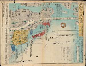
亞細亞小東洋圖 / [Map of Asia and Little Eastern Ocean].
sold
- Digital Map Information
- Suitable for large format printing
- File Size: 14.8 MB
- File Type: ZIP / TIFF
- ICC color profile embedded
- Delivered instantly via download link
This is a rare and historically significant 1857 map of East Asia (Japan, Korea, China, Annam, etc.) by the 18th century Japanese cartographer, geographer, and Sinologist Nagakubo Sekisui (長久保玄珠). At the time of publication in Japan, this map was regarded as especially accurate and a gold standard of Japanese cartography for nearly a century after its initial publication. It is also important because it includes several currently disputed islets, including: Dokdo/Takeshima (竹シマ), the Kuril Islands (唐度), and the Diaoyu/Senkaku Islands (高華). (more details)