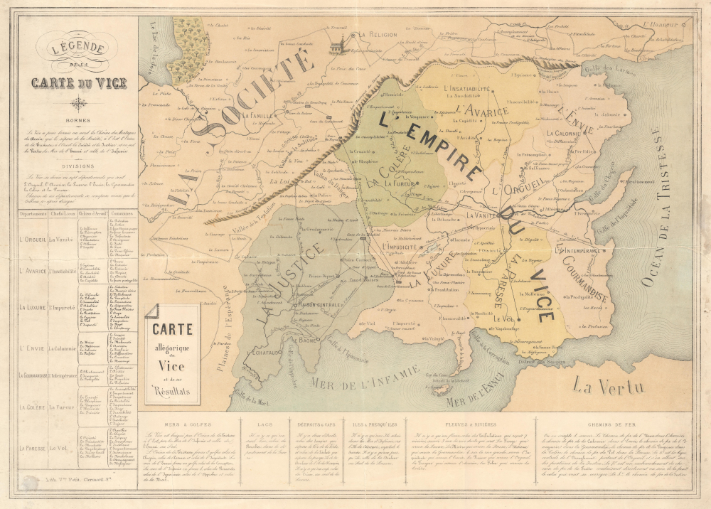
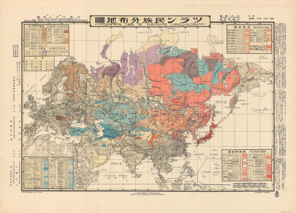
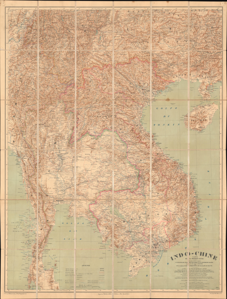
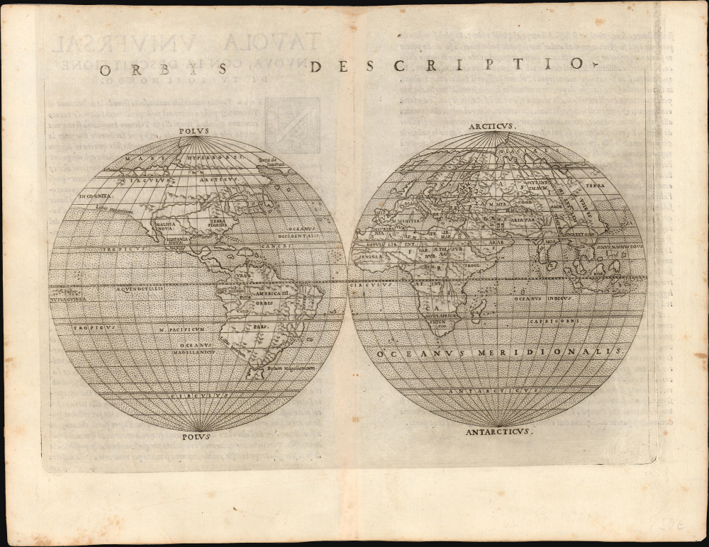
Most recently added antique and rare maps as of 6/18/2025.
1853 Colton Large-Scale Map of New York City, Brooklyn, Williamsburg
Striking large-format map of New York City.
$15,000.00

1661 Cellarius Celestial Map of the Northern Constellations:  Van Santen Color Heightened with Gold
Van Santen's matchless coloring heightened with lavish gold gilt.
$15,000.00

1661 Cellarius Celestial Map of Tycho Brahe's Solar System: Van Santen Color Heightened with Gold
Brahe's Model with Van Santen's matchless coloring heightened with lavish gold.
$15,000.00

1777 Le Rouge / Mitchell Map of the Colonial Era United States
Most important map in 18th century American history.
$12,000.00

1816 Cary Folding Wall Map of London, England
London in the Early Days of Britain's Imperial Century.
$10,000.00

1849 Colton Map of United States (Texas at Fullest) (First Edition) (Gold Rush)
Adding California and chronicling Texas' changing borders.
$10,000.00

1917 Hanot Pictorial Wall Map of the World Fur Trade
Amazing early pictorial map promoting the furrier business of Chapal.
$7,500.00

1870 Russell / Bufford View of Sperm Whaling Industry
'Towards thee I roll, thou all-destroying but unconquering whale...' -Melville
$5,000.00

1868 Pelton 'Poor Richard' Broadside: Wit and Wisdom of Benjamin Franklin
'The cat in gloves catches no mice...' - Franklin
$2,500.00

1719 John Senex Map of America With California as an Island
Enigmatic lakes in the American West.
$2,500.00

1884 Upton and Co. Folding Map of Auckland, New Zealand
Rare, Early Cadastral Map of New Zealand's Largest City, w/ Manuscript Annotations.
$2,400.00

1975 Bartniczak Manuscript Map of Grady Prisoner of War Camp (Stalag 324), Poland
One of the Largest Prisoner of War Camps on the Eastern Front.
$1,500.00

1944 Coscia Anti-American Fascist Propaganda, World War II
Last Gasps of Italian Fascism.
$1,500.00

1841 King / Egan 'Genealogical Tree' of British Naval Victories
'Whosoever commands the sea commands the trade; whosoever commands the trade of the world commands the riches of the world.' -Raleigh
$1,500.00

1606 / 1613 Hondius Map of the Strait of Magellan
First Complete Chart of the Strait of Magellan Based on Exploration.
$1,400.00

1852 Mitchell / Cowperthwait Pocket Map of Maine, New Hampshire, and Vermont
Birth of Railroads in Northern New England.
$750.00

1710 Homann Map of the Kingdom of Prussia
Establishing the Kingdom of Prussia. First Edition!
$600.00

1913 Wilson Folding Map of Avalon and Catalina Island, California
Early Days of Avalon and Catalina.
$600.00