
Polá De Torroella, Federico (sold)

Federico Polá De Torroella (1904 - March 10, 1977) was a Mexican civil engineer and cartographer active in Mexico and Guatemala in the middle of the 20th century. He worked with the Pan-American Sanitary Bureau throughout Central America, helping to map the region and research disease and sanitation. He was born in Coahuilla, Mexico and died in Mexico City, Mexico.
Rare 1940s large format map of Guatemala.
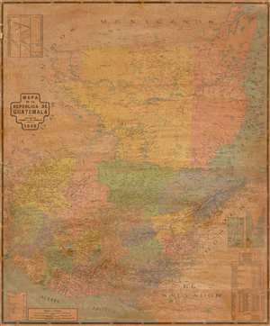
Mapa de la Republica de Guatemala.
sold
- Digital Map Information
- Suitable for large format printing
- File Size: 54.99 MB
- File Type: ZIP / TIFF
- ICC color profile embedded
- Delivered instantly via download link
This is a rare large format map of Guatemala and Belize issued by Federico Polá De Torroella in 1948. The map covers all of Guatemala from the Gulf of Honduras to the Pacific and from Mexico to El Salvador. An inset in the upper left illustrates comparative heights of volcanoes, mountains, and depths of lakes. Twin insets in the lower left highlight Turneffe Atoll and Ambergris Caye, today popular with Scuba Divers as a jumping point for the legendary Great Blue Hole! In thi scorner there is also a key with geographical data and demographic references. (more details)