
Purcell, Joseph (sold)

Joseph Purcell (1750 - 1807) was an Irish-American surveyor active in South Carolina in the late 18th and early 19th centuries. He emigrated to the United States around 1765 when he was 15 years old to apprentice under William Gerard De Brahm (1718 - 1799). His earliest work under De Brahm's tutelage include manuscript maps of Georgia and Florida. Completing his apprenticeship, Purcell took a position in Charleston under John Stuart (1718 - 1779), who headed the southern district of the British Indian Department. Under Stuart, Purcell completed a multi-sheet manuscript map illustrating south-eastern American Indian Lands - the so-called Stuart-Purcell map. Despite being an active surveyor, only one of Purcell's maps was ever printed, a post-Revolutionary war map of the southern United States compiled for Jedediah Morse's American Universal Geography. Most of his other work consisted of legal surveys, many of which survive, but none of which were published. There is some indication that he became involved in the slave trade. He will, written in March of 1806, was composed while. He was about to undertake a dangerous voyage on the Congo River. A prescient choice, as he died there in 1807. Back in Charleston, his substantial estate was auctioned, including 'one sextant, one level, and a complete set of surveyor’s instruments'.
The state of Franklinia. The first map of the United States by a Southerner.
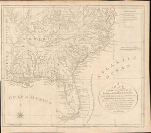
A Map of the States of Virginia, North Carolina, South Carolina and Georgia; Comprehending the Spanish Provinces of East and West Florida: Exhibiting the Boundaries as fixed by the late Treaty of Peace between the United States and the Spanish Dominions.
sold
- Digital Map Information
- Suitable for large format printing
- DPI: 600
- File Size: 242.41 MB
- File Type: ZIP / TIFF
- ICC color profile embedded
- Delivered instantly via download link
This 1792 Joseph Purcell map of the United States recording post-Revolutionary War westward expansion. This is one of the earliest maps to identify the ephemeral pseudo-state of Franklinia, the claims of the Ohio Company of Associates, the lands of the New Jersey and Wabash Companies, the Cumberland Settlement, and the Moravian Settlement. It is moreover, one of the best maps of the American Indian nations in the southeast - benefiting from Purcell's firsthand reconnaissance. Significantly, this is also the first maps of the United States by a southern cartographer. (more details)
The state of Franklinia. The first map of the United States by a Southerner.

A Map of the States of Virginia, North Carolina, South Carolina and Georgia; Comprehending the Spanish Provinces of East and West Florida: Exhibiting the Boundaries as fixed by the late Treaty of Peace between the United States and the Spanish Dominions.
sold
- Digital Map Information
- Suitable for large format printing
- DPI: 600
- File Size: 16.43 MB
- File Type: ZIP / TIFF
- ICC color profile embedded
- Delivered instantly via download link
This 1800 Vint and Anderson issue of the Joseph Purcell map of the United States recording post-Revolutionary War westward expansion. This is one of the earliest maps to identify the ephemeral pseudo-state of Franklinia, the claims of the Ohio Company of Associates, the lands of the New Jersey and Wabash Companies, the Cumberland Settlement, and the Moravian Settlement. It is moreover, one of the best maps of the American Indian nations in the southeast - benefiting from Purcell's firsthand reconnaissance. Significantly, this is also the first maps of the United States by a southern cartographer. (more details)