
Rodenbaugh, Henry Nathan (sold)
Height of the FEC System.
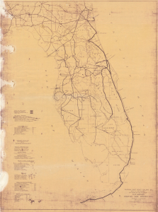
Florida East Coast Railway Co... Map showing Connections and Locations.
sold
- Digital Map Information
- Suitable for large format printing
- Full resolution TIFF file
- ICC color profile embedded
- Delivered instantly via download link
This 1921 Florida East Coast Railway engineering wall map, revised through 1924, was prepared by the company's Chief Engineer's Office in St. Augustine for internal reference. Its combination of railway connections, technical tables, and other information presents the transportation network near its height and during a period of breakneck development in South Florida. The map reflects the early 1920s expansion of settlement and agriculture, when rail access and drainage made new areas available to developers and farmers. (more details)