
Roeser, Charles 'Karl' Richard (sold)

Charles 'Karl' Richard Roeser, Jr. (December 15, 1842 - June 23, 1893) was a Prussian-American surveyor and draftsman working with the U.S. General Land Office in the second half of the 19th century. Roeser was born in Merseburg, Saalekreis, Saxony-Anhalt, Germany, but emigrated to the United States as a child with his family, settling in Wisconsin. In 1857-61 he took a degree in engineering from Lawrence University, Wisconsin, then went on to take a degree in law from Columbia. Shortly after the American Civil War (1861 - 1865) he entered public service as the Chief Draftsman of the General Land Office. He issued an 1875 map of the United States and an 1876 Centennial atlas of the United States, the Geographical and political atlas of the states and territories of the United States of America. He transferred to the Topographer's Office under Postmaster General Howe in 1882 with the mission to fully reorganize and modernize that department's mapping resources. His tenure was brief, as political infighting around civil service reform caused him to be sacked and replaced by his predecessor, Walter Nicholson. Roeser nevertheless instituted several important reforms that helped professionalize the Topographer's office and improve its efficiency, keeping with his civil service reform beliefs.
Culmination of 60 years of GLO surveying.
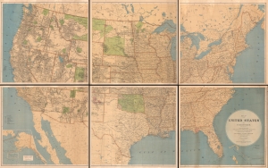
Map of the United States and Territories showing the extent of Public Surveys, Indian and Military Reservations, Land Grant R.R., Railroads, Canals, and other details, compiled from the official surveys of the General Land Office, and other authentic sources, under the direction of the Hon. J. A. Williamson, Commissioner, 1876.
sold
- Digital Map Information
- Suitable for large format printing
- File Size: 238.16 MB
- File Type: ZIP / TIFF
- ICC color profile embedded
- Delivered instantly via download link
An impressive and rare 1876 wall map of the United States drafted by Charles Roeser and issued by the General Land Office under James A. Williamson. The culmination of 60 years of GLO survey work, this map is the state-of-the-art cartographic representation of the United States in the late 19th century. (more details)
Indian Wars, gold and silver discoveries, and the construction of the Northern Pacific Railroad.
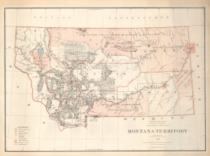
Montana Territory.
sold
- Digital Map Information
- Suitable for large format printing
- File Size: 77.64 MB
- File Type: ZIP / TIFF
- ICC color profile embedded
- Delivered instantly via download link
An impressive large scale 1879 map of Montana during its territorial period. It is one of the earliest obtainable maps of Montana Territory, covering its formative period during various Indian Wars, gold and silver discoveries, and the construction of the Northern Pacific Railroad. (more details)
Massive Late 19th Century Postal Map of New England
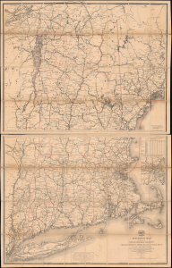
Post Route Map of the States of New Hampshire, Vermont, Massachusetts, Rhode Island, Connecticut, and Parts of New York and Maine.
sold
- Digital Map Information
- Suitable for large format printing
- Full resolution TIFF file
- ICC color profile embedded
- Delivered instantly via download link
This is a large (62.5 x 39 in) two-sheet 1883 map of the New England states issued for internal use by the United States Postal Service. A highly detailed map, it is a testament to the remarkable reach of the Postal Service into even the most rural corners of New England. The map is dissected into two panels that fold neatly into an elegantly tooled leather slipcase. (more details)