
Roussel (sold)

Roussel (16xx - August 30, 1733) was a French engineer whose first name has been lost to history and about whom very little is known. He was named chief engineer in 1719 and a knight of the Order of Saint-Louis in 1718. He was part of the team of engineers sent to the French borders by Louis XIV beginning in 1691. Over the course of his career, he made many city maps, including Turin, Asti, Toulon, and Briançon, along with regional maps of the French border regions. Among these regional maps is a famous map of the Pyrenees border region. When he was named chief of engineers, he was the first geographic engineer to be named to the position since the corps was founded in 1713.
Published during the French Revolution.
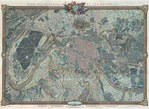
Paris, ses Fauxbourgs, et ses Environs.
sold
- Digital Map Information
- Suitable for large format printing
- DPI: 600
- File Size: 260.28 MB
- File Type: ZIP / TIFF
- ICC color profile embedded
- Delivered instantly via download link
This is a striking 1795 - 1796 Roussel wall-sized city plan or map of Paris, France, and its environs - one of the few large-scale maps of Paris issued during the French Revolution (1789 - 1799). Within Paris, buildings, squares, and parks are illustrated, with the Palais des Tuileries, the Louvre, the Hotel Royal des Invalides, and Notre Dame, among many other famous buildings recognizable. Churches are highlighted in blue, while Paris's many gardens, including the Champs-Elysées, the Champs de Mars, the Jardin des Tuileries, and the Jardin du Luxembourg, appear in green. Some of the most important buildings are illustrated pictorially, including the Abbaye St. Victor, the menagerie in today's Jardin des Plantes, and the factories across the Seine from the Jardin des Plantes. Outside Paris proper, spectacular illustrations of Montmarte and the Butte Chaumont appear. Paris's suburbs are illustrated and labeled as well, many of which are modern-day neighborhoods. (more details)