
Sancha, Antonio de (sold)

Antonio de Sancha (1720—1790) was a Spanish printer active in Madrid. He worked for the printer-bookseller Sanz before opening his own bookshop and, in 1771, a printing office.
One of the Earliest Maps of Chile by a Chilean.
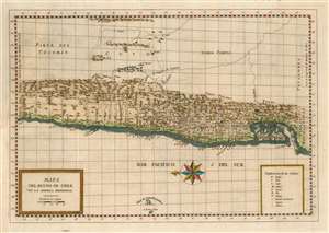
Mapa Del Reyno De Chile En La America Meridional.
sold
- Digital Map Information
- Suitable for large format printing
- DPI: 600
- File Size: 10.65 MB
- File Type: ZIP / TIFF
- ICC color profile embedded
- Delivered instantly via download link
This is a 1788 map of the Kingdom of Chile, produced for inclusion in Juan Ignacio Molina's Compendio de la Historia Geográfica, Natural y Civil del Reino de Chile. The map is among the few maps of the region based on information from someone who actually lived there; Molina's experience as a naturalist and ornithologist brought him far afield, and the map reflects a deeper knowledge of areas away from the coastline than do previous maps. The east-oriented map extends from Peru to south of Chiloe island. The abundant settlement of the coastal strip and its rivers are clearly defined. Chile's mountainous terrain is depicted pictorially, and thirteen active volcanoes are marked on the map. (more details)