
Schmidt, Carl (sold)

Carl Schmidt (fl. c. 1875 – 1929) was a German cartographer, geographer, and geologist who often collaborated with the cartographer Bruno Hassenstein.
Map of Korea and blueprint for foreign control.
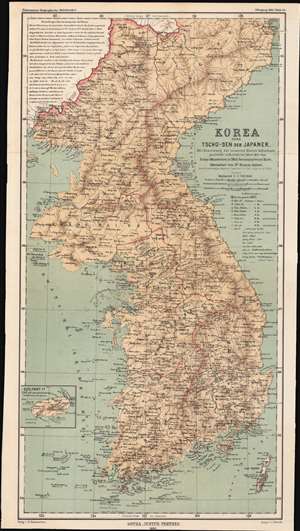
Korea oder Tscho-sen der Japaner / [Korea, or Japanese Chōsen].
sold
- Digital Map Information
- Suitable for large format printing
- File Size: 14.84 MB
- File Type: ZIP / TIFF
- ICC color profile embedded
- Delivered instantly via download link
This is an 1883 map of the eight provinces of Chosŏn Korea, partially translated into German from an English-language map, which in turn was based on a map made by the Japanese military in 1875. The convoluted history of this map shows both the curiosity about the 'hermit kingdom' and the competing imperial interests that would be at play once Korea was forcibly opened to greater foreign influence. (more details)