
Seaton, Robert (sold)

Robert Seaton (fl. c. 1835 - 1836) was a British mapmaker who held the post of Hydrographer to the King. Despite the impressive title, we are only able to identify two maps by Seaton, Seaton's Map of Palestine and the Holy Land, and a New Map of England and Wales, both engraved by Josiah Neele (1804 - 1876) and published in 1835.
One of the most beautiful maps of the Holy Land from the 19th century.
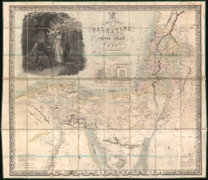
Seaton's Map of Palestine, or the Holy Land, with part of Egypt.
sold
- Digital Map Information
- Suitable for large format printing
- DPI: 600
- File Size: 67.38 MB
- File Type: ZIP / TIFF
- ICC color profile embedded
- Delivered instantly via download link
This is a first edition example of Robert Seaton's 1835 map of Palestine or the Holy Land. It is one of the most decorative maps of the Israel / Palestine / Syria region to appear in the 19th century. (more details)