
Shapiro, Joseph (sold) (יוסף שפירא )
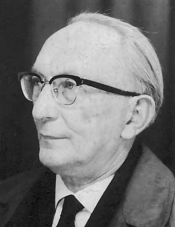
Joseph Shapiro (יוסף שפירא) (1900 - December 4, 1967), also spelled Josef Szapiro, was a Polish-Israeli publisher and cartographer active in Israel in the middle part of the 20th century. Shapiro was born in Łódź, which was in the part of Poland partitioned by the Russian Empire. He studied at the Hebrew school in Łódź, then moved on to study economics and philosophy at Mannheim and Heidelberg, Germany, receiving a doctorate from Heidelberg in 1924. He immigrated to Eretz Israel in 1935. He began his own publishing interest around 1940, publishing maps and atlases of Israel - often covering the various wars and most up-to-date events. His final work was a series of maps illustrating the Six-Day War (June 5, 1967 - June 10, 1967). His wife, Esther Lurie (1913 - 1998), was a prominent painter. When he died of a heart attack in 1967, the publishing business passed on to his son, Shaul Shapira (1947 - ????).
AKA: יוסף שפירא
Social Realism and Zionism.
Second Year of the State of Israel.
sold
- Digital Map Information
- Suitable for large format printing
- File Size: 60.39 MB
- File Type: ZIP / TIFF
- ICC color profile embedded
- Delivered instantly via download link
A rare and striking 1949 Joseph Szapiro (Schapiro) Zionist map of Israel, with striking Social Realist imagery, celebrating the second anniversary of Israel's 1947 founding. The map depicts the region from the Mediterranean Sea to Jordan (Transjordan) and Syria and from Lebanon to Egypt and the Gulf of Eilat (Gulf of Aqaba). Highly detailed, cities, towns, and villages are labeled throughout, with Jerusalem and Tel Aviv given prominence. (more details)
Social Realism and Zionism.
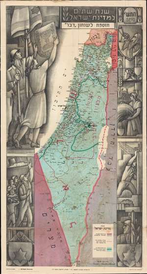
Second Year of the State of Israel. / שנת שתיים למדינת ישראל
sold
- Digital Map Information
- Suitable for large format printing
- File Size: 54.84 MB
- File Type: ZIP / TIFF
- ICC color profile embedded
- Delivered instantly via download link
A rare and striking 1950 Joseph Szapiro (Shapiro) Zionist map of Israel in Hebrew, with striking Social Realist imagery, celebrating the second anniversary of Israel's 1948 founding. The map depicts the region from the Mediterranean Sea to Jordan (Transjordan) and Syria and from Lebanon to Egypt and the Gulf of Eilat (Gulf of Aqaba). Highly detailed, cities, towns, and villages are labeled throughout, with Jerusalem and Tel Aviv given prominence. (more details)
Social Realism and Zionism.
Second Year of the State of Israel. / שנת שתיים למדינת ישראל
sold
- Digital Map Information
- Suitable for large format printing
- File Size: 29.11 MB
- File Type: ZIP / TIFF
- ICC color profile embedded
- Delivered instantly via download link
A rare and striking 1950 Joseph Szapiro (Shapiro) Zionist map of Israel in Hebrew, with striking Social Realist imagery, celebrating the second anniversary of Israel's 1948 founding. The map depicts the region from the Mediterranean Sea to Jordan (Transjordan) and Syria and from Lebanon to Egypt and the Gulf of Eilat (Gulf of Aqaba). Highly detailed, cities, towns, and villages are labeled throughout, with Jerusalem and Tel Aviv given prominence. (more details)
Socialist Realsim in Isreal - 3rd Year.
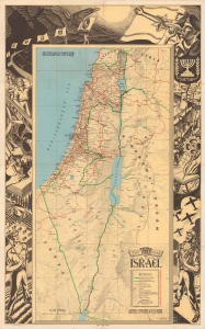
The Third Year of the State of Israel.
sold
- Digital Map Information
- Suitable for large format printing
- Full resolution TIFF file
- ICC color profile embedded
- Delivered instantly via download link
This is Joseph Szapiro's 1950 English-language map celebrating the third year of the State of Israel, with drawing and lettering by Isidor Ascheim and a pictorial border signed by Myer Isaacman. Its detailed geography records Israel's settlement expansion after independence. At the same time, the surrounding illustrations, in a Socialist Realism style, depict immigration, agriculture, scientific research, construction, and defense as interconnected foundations of the new state. (more details)
Soon after the Founding of Israel.
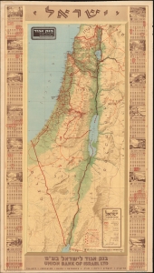
ישראל / [Israel].
sold
- Digital Map Information
- Suitable for large format printing
- File Size: 53.58 MB
- File Type: ZIP / TIFF
- ICC color profile embedded
- Delivered instantly via download link
A fascinating calendar and map of Israel published soon after its founding, this work was produced in 1953 for the Union Bank of Israel (more commonly known as Bank Igud). Among other features, it highlights the still-recent 'borders' of Israel, set according to the armistice lines following the 1948 Arab-Israeli War. (more details)
An Israeli map of the 1956 Suez Crisis.
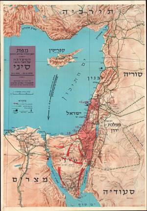
מפת האגן המזרחי של הים התיכון : המערכה על חצי האי סיני / [Map of the Eastern Basin of the Mediterranean: The Battle of the Sinai Peninsula].
sold
This is a 1956 Joseph Shapiro (Szapiro) Hebrew map of the Middle East centered on Israel during the 1956 Suez Crisis, also known as the Second Arab-Israeli War. It highlights the advances of Israeli forces across the Sinai Peninsula during the brief conflict. (more details)
Biblical Tourism and the Jewish State
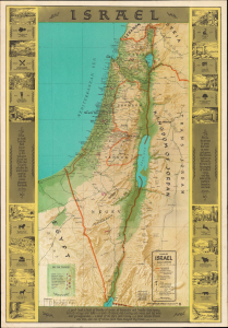
A visually engaging 1963 Joseph Shapiro map of Israel, blending the geography of the modern state with the Biblical landscape of antiquity. Issued during the brief period between Israel's establishment and the territorial transformations of 1967, it depicts the country within the 1949 Armistice Lines while overlaying modern roads, settlements, and infrastructure with ancient place names, archaeological sites, Biblical quotations, and pictorial views. Its English text and extensive visitor guidance suggest the map was designed for the growing Anglo-American tourist market, presenting Israel as both a young modern nation and the setting of Biblical history. (more details)