
Shope, Irvin 'Shorty' (sold)
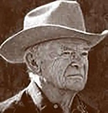
Irvin 'Shorty' Shope (1900 – November 22, 1977) was an American artist, particularly of the American West. Born in Boulder, Montana, at the age of nineteen he began working as a ranch hand and rode the range intermittently until the age of thirty. He received a degree in fine arts from the University of Montana in 1933 and began seriously working as a commercial artist in 1935, although he had received commissions before then. He died in Helena, Montana, having lived nearly all his life in the West. Shope was also one of the founding members of the Cowboy Artists of America.
Incredile pictorial map recounting Montana's frontier history.
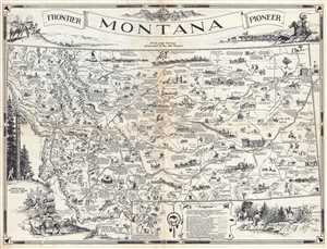
Montana. Frontier. Pioneer.
sold
- Digital Map Information
- Suitable for large format printing
- File Size: 10.36 MB
- File Type: ZIP / TIFF
- ICC color profile embedded
- Delivered instantly via download link
This is a 1937 Irvin Shope pictorial map of Montana. The map depicts the state from Idaho to the Dakotas and from Canada to Wyoming, including Yellowstone National Park. Highly detailed, myriad captions, vignettes, and other illustrations populate the map, creating ... (more details)
Incredible pictorial map recounting Montana's frontier history.
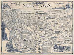
Montana. Frontier. Pioneer.
sold
- Digital Map Information
- Suitable for large format printing
- File Size: 9.39 MB
- File Type: ZIP / TIFF
- ICC color profile embedded
- Delivered instantly via download link
This is a 1937 Irvin Shope pictorial map of Montana. The map depicts the state from Idaho to the Dakotas and from Canada to Wyoming, including Yellowstone National Park. Highly detailed, myriad captions, vignettes, and other illustrations populate the map, creating ... (more details)
Incredible pictorial map recounting Montana's frontier history.
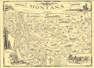
Montana. Frontier. Pioneer.
sold
- Digital Map Information
- Suitable for large format printing
- File Size: 19.2 MB
- File Type: ZIP / TIFF
- ICC color profile embedded
- Delivered instantly via download link
This is a 1937 Irvin Shope pictorial map of Montana. The map depicts the state from Idaho to the Dakotas and from Canada to Wyoming, including Yellowstone National Park. Highly detailed, myriad captions, vignettes, and other illustrations populate the map, creating a visual representation of Montana's history. Most of the captions recount tales of the Wild West, outlaws, vigilantes, and frontier violence and 'justice' abound. Others inform the viewer of more conventional milestones, such as the location of the first Territorial Legislature or that Virginia City was the first capital of the Montana Territory. Numerous cities and towns of all sizes are labeled, including Helena, Missoula, and Bozeman. Vignettes frame the map, illustrating 'the major frontier industries: trapping, mining, cattle and sheep raising, and lumbering'. A legend along the bottom border explains the various notations utilized on the map. (more details)
Incredible pictorial map recounting Montana's frontier history.
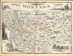
Montana. Frontier. Pioneer.
sold
- Digital Map Information
- Suitable for large format printing
- Full resolution TIFF file
- ICC color profile embedded
- Delivered instantly via download link
This is a 1937 Irvin Shope pictorial map of Montana. The map depicts the state from Idaho to the Dakotas and from Canada to Wyoming, including Yellowstone National Park. Highly detailed, myriad captions, vignettes, and other illustrations populate the map, creating a visual representation of Montana's history. Most of the captions recount tales of the Wild West, outlaws, vigilantes, and frontier violence and 'justice' abound. Others inform the viewer of more conventional milestones, such as the location of the first Territorial Legislature or that Virginia City was the first capital of the Montana Territory. Numerous cities and towns of all sizes are labeled, including Helena, Missoula, and Bozeman. Vignettes frame the map, illustrating 'the major frontier industries: trapping, mining, cattle and sheep raising, and lumbering'. A legend along the bottom border explains the various notations utilized on the map. (more details)
Montana's frontier history.
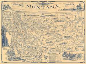
Montana. Frontier. Pioneer.
sold
- Digital Map Information
- Suitable for large format printing
- Full resolution TIFF file
- ICC color profile embedded
- Delivered instantly via download link
This is a 1937 Irvin Shope pictorial map of Montana. The map depicts the state from Idaho to the Dakotas and from Canada to Wyoming, including Yellowstone National Park. Highly detailed, captions, vignettes, and other illustrations populate the map, offering a visual representation of Montana's history. Most captions recount tales of the Wild West. Outlaws, vigilantes, and frontier violence and 'justice' abound. Others inform the viewer of more conventional milestones, such as the location of the first Territorial Legislature, or that Virginia City was the first capital of the Montana Territory. Numerous cities and towns appear, including Helena, Missoula, and Bozeman. Vignettes frame the map, illustrating 'the major frontier industries: trapping, mining, cattle and sheep raising, and lumbering'. (more details)
Montana's frontier history.
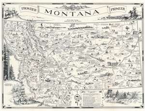
Montana. Frontier. Pioneer.
sold
- Digital Map Information
- Suitable for large format printing
- Full resolution TIFF file
- ICC color profile embedded
- Delivered instantly via download link
This is a 1937 Irvin Shope pictorial map of Montana. The map depicts the state from Idaho to the Dakotas and from Canada to Wyoming, including Yellowstone National Park. The map is highly detailed, with captions, vignettes, and other illustrations populating it, offering a rich visual representation of Montana's history. Most captions recount tales of the Wild West. Outlaws, vigilantes, and frontier violence and vigilante 'justice' abound. Others inform on more conventional milestones, such as the location of the first Territorial Legislature, or that Virginia City was the first capital of the Montana Territory. Numerous cities and towns appear, including Helena, Missoula, and Bozeman. Vignettes frame the map, illustrating 'the major frontier industries: trapping, mining, cattle and sheep raising, and lumbering'. (more details)
Montana's frontier history.
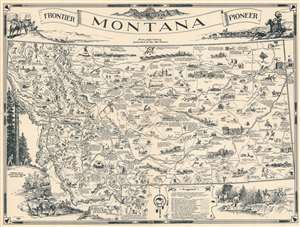
Montana. Frontier. Pioneer.
sold
- Digital Map Information
- Suitable for large format printing
- Full resolution TIFF file
- ICC color profile embedded
- Delivered instantly via download link
This is a 1937 Irvin Shope pictorial map of Montana. The map depicts the state from Idaho to the Dakotas and from Canada to Wyoming, including Yellowstone National Park. The map is highly detailed, with captions, vignettes, and other illustrations populating it, offering a rich visual representation of Montana's history. Most captions recount tales of the Wild West. Outlaws, vigilantes, and frontier violence and vigilante 'justice' abound. Others inform on more conventional milestones, such as the location of the first Territorial Legislature, or that Virginia City was the first capital of the Montana Territory. Numerous cities and towns appear, including Helena, Missoula, and Bozeman. Vignettes frame the map, illustrating 'the major frontier industries: trapping, mining, cattle and sheep raising, and lumbering'. (more details)
Montana's frontier history.
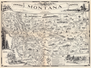
Montana. Frontier. Pioneer.
sold
- Digital Map Information
- Suitable for large format printing
- Full resolution TIFF file
- ICC color profile embedded
- Delivered instantly via download link
This is a 1937 Irvin Shope pictorial map of Montana. Depicting from Idaho to the Dakotas and from Canada to Wyoming (including Yellowstone National Park), Shope populates Montana with captions, vignettes, and other illustrations, offering a rich visual representation of Montana's history. Most captions recount tales of the Wild West. Outlaws, vigilantes, frontier violence, and vigilante 'justice' abound. Others inform on more conventional milestones, such as the location of the first Territorial Legislature, or that Virginia City was the first capital of the Montana Territory. Numerous cities and towns appear, including Helena, Missoula, and Bozeman. Vignettes frame the map, illustrating 'the major frontier industries: trapping, mining, cattle and sheep raising, and lumbering'. (more details)
Follows the Lewis and Clark Expedition.
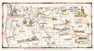
The Trail of Lewis and Clark 1804 - 1806.
sold
- Digital Map Information
- Suitable for large format printing
- File Size: 19.56 MB
- File Type: ZIP / TIFF
- ICC color profile embedded
- Delivered instantly via download link
This is a 1945 Irvin Shope pictorial map of the western United States commemorating the Lewis and Clark Expedition. Depicting from the Mississippi River west to the Pacific, a solid red line traces Lewis and Clark's route from Wood River, Illinois, up the Missouri River to Montana, west to the Snake and Columbia Rivers, and on to Astoria, Oregon. Pictorial vignettes highlight their 3-year expedition, including the keel boat the expedition took up the Missouri, portaging canoes around the great falls of the Missouri, and Sacajawea recognizing the Shoshone. Dashed red lines trace deviations on the return voyage. The various yellow lines follow other famous trails of the American West, including the Oregon Trail, the Pony Express, the Santa Fe Trail, and the Mormon Trail. Shope includes other vignettes illustrating aspects of pioneer western life, such as a covered wagon being pulled by a team of oxen, a Pony Express rider, bison, pronghorn antelope, and a stagecoach. (more details)
Highlights the Oregon Trail!
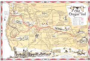
Old Oregon Trail.
sold
- Digital Map Information
- Suitable for large format printing
- File Size: 17.24 MB
- File Type: ZIP / TIFF
- ICC color profile embedded
- Delivered instantly via download link
This is a 1948 Irvin Shope pictorial map of the western United States highlighting the Oregon Trail and its offshoots. A thick red line highlights the Oregon Trail, and offshoots, such as the California Trail, are emphasized with dashed lines. Important waypoints are labeled, including Chimney Rock in Nebraska and South Pass in Wyoming. Other highlighted trails include the Santa Fe Trail, the Overland Stage Route, Lewis and Clark's route to the Pacific, and the celebrated Pony Express Route. Pictorial vignettes illustrate different aspects of the journey west. Covered wagons pulled by teams of oxen, Native Americans hunting bison and stalking settlers, and even a wagon floating across a river decorate the map. A stunning illustration of Fort Laramie and a covered wagon occupy the bottom portion of the map and truly encapsulate the popular stereotype of life in the Old West. Short captions offer historical facts about westward expansion. These note the importance of frontier forts, such as Bent's Fort and significant moments in westward exploration. (more details)