
Takehara Yoshibē (sold) (竹原好兵衞)

Takehara Yoshibē (竹原好兵衞; c. 1774 - 1868) was a Japanese publishing house active in the late Tokugawa period that primarily produced maps relating to Kyoto. The publishing house was likely named after its founder and carried on the name after his death.
AKA: 竹原好兵衞
A guide to the beauty and splendor of the imperial city.
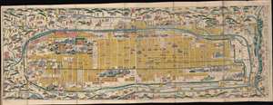
都名所自在步行 / [Stroll around Famous Sites of Kyoto].
sold
- Digital Map Information
- Suitable for large format printing
- Full resolution TIFF file
- ICC color profile embedded
- Delivered instantly via download link
This is a very rare 1863 edition of a folding map for tourists and pilgrims to Kyoto, Japan, made by the publishing house Takehara Yoshibē. It is the product of a decades-long evolution of tourist maps for Kyoto, resulting in a delicate balance between aesthetics, comprehensiveness, and utility. (more details)