
Taylor, Benjamin (sold)

Benjamin Taylor (1746 - 1832) was a New York city surveyor active in the post Revolutionary War period. Taylor was born in Yorktown, Westchester, New York. He enlisted with the Colonial Army at the age of 16 and served in several wars, including the French and Indian War and the American Revolutionary War. It was most likely during the war that Taylor developed his surveying expertise. After being discharged, on June 9th of 1783, Taylor established himself as contract surveyor in New York city. Taylor's corpus consists of countless surveys of various parts of New York, Brooklyn, Williamsburg, Harlem and Queens. He was a contemporary of Casmir Goerck, another well known surveyor of the period, and it is known that they collaborated on a number of important maps. Taylor is best known for his important map of New York City. He died in Fishkill, Dutchess County, New York in 1832.
A historic manuscript survey of Tribeca from the 1700s.

A Map shewing the arrangemnt agreed to between the Corporation of Trinity Church, and the Proprietors of the Estate late Ireland's, with regard to Streets, &c. &c.
sold
- Digital Map Information
- Suitable for large format printing
- Full resolution TIFF file
- ICC color profile embedded
- Delivered instantly via download link
This is a rare historic 1796 indenture and associated manuscript survey map documenting the transfer of certain lands in the Tribeca district of Manhattan from the Trinity Church Corporation to the City of New York. The indenture agreement bears the signatures of ... (more details)
Uncommon persuasive map illustrating the global progress of Christian evangelization.
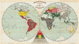
Prevailing Religions of the World and Progress of Evangelization.
sold
- Digital Map Information
- Suitable for large format printing
- File Size: 8.71 MB
- File Type: ZIP / TIFF
- ICC color profile embedded
- Delivered instantly via download link
A curious 1894 map of the world that attempts to map the religious deportment and the progress of evangelization. The map, which is printed on waxed linen, uses bold printed color to identify various religious groups: 'Greek and Oriental' (Orthodox Christianity), ... (more details)
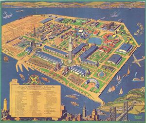
A Cartograph of Treasure Island in San Francisco Bay Golden Gate International Exposition.
sold
- Digital Map Information
- Suitable for large format printing
- Full resolution TIFF file
- ICC color profile embedded
- Delivered instantly via download link
This is an attractive 1940 bird's eye view of Treasure Island in San Francisco Bay, California. Created to depict the fairgrounds of the Golden Gate International Exposition held in 1839 and 1840, the view depicts part of San Francisco in the foreground with ... (more details)