
Bureau Topographique des Troupes de l'Indo-Chine (sold)

Bureau Topographique des Troupes de l'Indo-chine (fl. c. 1886 - 1900) was founded in 1886 in Hanoi. Its first major project was a 1:2000000 map of the entirety of Indochina, for which they drew on source maps created by the Service Hydrographique de la Marine and those created by an expeditionary corps sent throughout the region. Before establishing its own printing facilities in Indochina in 1890, the Bureau Topographique transferred their work back to Paris to be printed by the Service Géographique de l'Armée. In 1890 the Bureau Topographique also began to increase its cartographic output. The Bureau Topographique sent army officers on triangulation and topographic missions in unexplored areas of Indochina throughout the 1890s, some of which proved fatal for the participants. It is unclear when the Bureau Topographique shut down, but no examples of their work postdate 1900.
First scientific map of Laos.
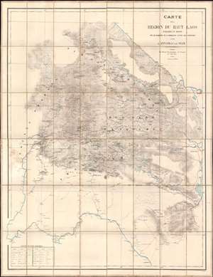
Carte de al Région du Haut Laos Explorée en 1888-1889 par les Membres e a Comission d'Etude des Frontieres entre L'Annam et le Siam.
sold
- Digital Map Information
- Suitable for large format printing
- Full resolution TIFF file
- ICC color profile embedded
- Delivered instantly via download link
Considered the first scientific survey of Laos, this seminal map was published immediately following the 1889 completion of the second Mission Pavie - the expedition that laid the groundwork for the French Protectorate in Laos. The map is signed by its creator, Auguste Jean-Marie Pavie, and dedicated to 'Monsieur Piquet', referring to Georges Jules Piquet (1839 - 1923), Gouverneur Général of French Indochina from 1888 - 1889, under whose auspices the Second Mission Pavie was undertaken. It further features manuscript content by another mission participant, Victor-Alphonse Massie (1854 - 1892), recommending the placement of a border watch post. The map further notes, in manuscript, Nam Youm (Laos), where the White Tai bandit leader Đèo Văn Trị, was then active. This map is significant on many levels: first as the result of one of the most extraordinary missions of exploration undertaken in Southeast Asia; second, as the first scientific survey of what is today northern Laos; third; as the underpinning of subsequent French Protectorate in Laos; fourth, as the personal copy owned by the Gouverneur Général of French Indochina who ordered the 2nd Mission Pavie. (more details)