
Tulloch, David (sold)

David Tulloch (1829 - September 17, 1869) was a Scottish-Australian engraver active in Melbourne in the mid-19th century. Tulloch emigrated from Greenock, Scotland, to Melbourne, Australia in January of 1849. It was initially employed by Thomas Harn, publisher of Harn's Illustrated Australian Magazine. In 1851, Tulloch followed prospectors to the 'gold diggings', producing some of the first on-site illustrations of the Victoria Gold Rush. In November of 1851, Tulloch established his own printing and lithography firm in Melbourne. Two years later, in 1853, he brought the map and line engraver James Davie Brown into the business. The duo produced several views and maps, receiving awards at the Victoria Industrial Exhibitions, but nonetheless dissolved their arrangement in 1856. Afterwards Tulloch fell into hard times. During his period, he produced several on-demand engravings for various Australia firms, including De Gruchy and Leigh, Fergusson and Mitchell, and Whitehead and Co. In 1859, he engraved vignettes for Frederick Proeschel's important map of Victoria In 1860, he was briefly employed by the Victoria Geological Survey, creating lithographic hachures. He filed for bankruptcy in 1861, but nothing seems to have come from it. From 1864 to 1866 he appeared in Melbourne directories as an engraver based at 91 Cecil Street, Emerald Hill (South Melbourne). On September 17, 1869, Tulloch died of pulmonary tuberculosis.
Victoria Gold Rush!
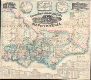
General, Agricultural, and Gold Fields Map of Victoria.
sold
- Digital Map Information
- Suitable for large format printing
- Full resolution TIFF file
- ICC color profile embedded
- Delivered instantly via download link
This is a rare 1859 Frederick Proeschel pocket map of Victoria, Australia, published to capitalize on Victoria Gold Rush emigration. Such maps were sold cheaply to hopeful prospectors who often carried them in-hand to mining and agricultural camps - the harsh conditions contributing to such maps having exceptionally low survival rate. The central cartouche engraved by D. Tulloch, illustrates Victoria's many blessings, including rich flora and fauna, excellent agricultural lands, and of course, the all-important gold mines. Herein, gold 'diggings' are highlighted throughout in brilliant yellow - offering essential data to the emigrant. In addition, the map names settlements, offers commentary on terrain, and highlights both planned and active transportation networks. For those disinclined to rough gold camp life, It also notes 'good sheep pastures'. A view of the Geelong town hall occupies the upper left, and a view of the Melbourne 'Gold Office' the upper right. Three inset maps illustrate, from left to right, the southern hemisphere, the world on a Mercator projection (with Australia at the center) and Australasia. Statistics are included along the bottom border, with particular attention to 'principal gold field townships or diggings', the values of gold extracted from specific fields, Victoria's exports, and Great Britain's exports. (more details)