
Utne, Y. (sold)

Y. Utne (fl. c. 1909 - 1936) was a surveyor active in Shanghai prior to World War II. Utne surveyed for the Whangpoo Conservancy Board from at least 1909, when he is listed as an 'Assistant Surveyor,' to the date of his last known work, 1934. He surveyed several detailed maps of the Huangpu River in the vicinity of Shanghai. Utne returned to England with the Japanese invasion of Shanghai in 1936, where he is listed on the Empress of Asia passenger manifest as the 'Chief Surveyor' of the WCB.
Extraordinary Shanghai Harbor infrastructure map.
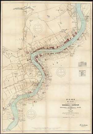
Shanghai Harbour Published by the Whangpoo Conservancy Board.
sold
- Digital Map Information
- Suitable for large format printing
- File Size: 116.98 MB
- File Type: ZIP / TIFF
- ICC color profile embedded
- Delivered instantly via download link
A massive and previously unknown 1927 separate issue dissected wall map of Shanghai, China published by E. C. Stacker and Y. Utne for the Whangpoo Conservancy Board. Centered on the Shanghai Bund, the map details development along the Huangpu River (黄浦江, Whangpoo) from, roughly, the modern district of East Gate (小东门), south to Longhuacun (龙华村). While the focus is on riverside development, wherein individual buildings, docks, diplomatic offices, public utilities, parks, and business are noted; major inland roads are also identified in both English and Chinese. (more details)