
Weigel, Christoph (sold)

Christoph Weigel (November 9, 1654 - February 5, 1725) was a German goldsmith, printer, and engraver based in Nuremburg. Weigel apprenticed in engraving in the publishing center of Augsburg after which he held various positions in Vienna and Frankfurt. Eventually Weigel worked his way to 18th century printing Mecca of Nuremburg where, in 1698, he became a citizen of the city and established his own firm. Weigel is known to have worked closely with the most prominent of the Nuremburg map publishers J. B. Homann as well as with with his brother Johann Christoph Weigel (1654 - 1726) and the printer, Kohler. Following Weigel's passing in 1725, control of the firm passed to his widow, who published a number of Weigel's maps and atlases posthumously. The widow Weigel eventually ceded control of the firm to her son, Johann Christoph Weigel the younger (?? - 1746) who partnered with Schneider to publish as Schneider-Weigel. The Schneider-Weigel firm continued to publish until the early 19th century.
Scarce early map of Asia offering a speculative Hokkaido.
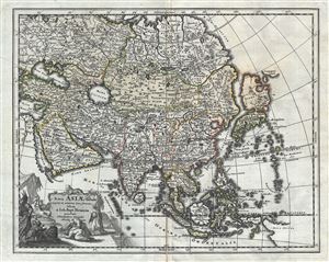
Nova Asiae Tabula e majori in minorem hanc formam reducta a Ioh. Bapt. Homann excudente Christophero Weigelio Noribergae.
sold
- Digital Map Information
- Suitable for large format printing
- DPI: 300
- File Size: 8.07 MB
- File Type: ZIP / TIFF
- ICC color profile embedded
- Delivered instantly via download link
A scarce 1719 Christopher Weigel and J. B. Homann map of Asia. Based upon an earlier map of J. B. Homan, this Weigel reduction covers all of Asia from the Black Sea to Japan and from Nova Zembla to New Guinea. There is an elaborate allegorical title cartouche ... (more details)
18th century map of India and Southeast Asia incorporating Ptolemaic geography with elaborate 'war elephant' cartouche.
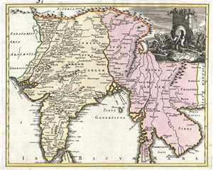
India Intra et Extra Gangem.
sold
- Digital Map Information
- Suitable for large format printing
- DPI: 300
- File Size: 6.36 MB
- File Type: ZIP / TIFF
- ICC color profile embedded
- Delivered instantly via download link
An exceptional 1720 map of India and Southeast Asia from Christoph Weigel's Descriptio Orbis Antiqui , this map incorporates Ptolemaic geography with 18th century geography. All the place names on this map come from the Geographia of Claudius Ptolemy, which have ... (more details)
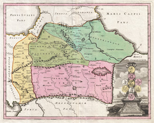
Armenia Vtraque.
sold
- Digital Map Information
- Suitable for large format printing
- DPI: 300
- File Size: 13.42 MB
- File Type: ZIP / TIFF
- ICC color profile embedded
- Delivered instantly via download link
An uncommon 1720 map of the Caucuses by Christopher Weigel. This most unusual aspect of this map is its focus on the lands between the Black Sea and the Caspian, commonly known as the Caucuses. In antiquity most of this region was part of the Armenian Empire ... (more details)
Europe's Kings, Emperors and Popes at a Glance.
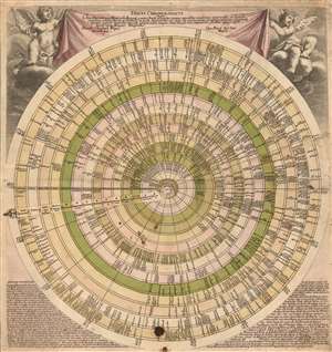
Discus Chronologicus.
sold
- Digital Map Information
- Suitable for large format printing
- Full resolution TIFF file
- ICC color profile embedded
- Delivered instantly via download link
This is Christopher Weigel's 1745 ingenious circular historical chart listing the reigns of the monarchs of Europe, as well as the Papacy, the Byzantine emperors and the Turkish Sultans. The chart lists fourteen categories of rulers chronologically from 1 CE to a potential limit of 1800 CE. A rotating volvelle - with each specific empire noted - allows the reader to rotate to see, at a glance, which monarchs reigned contemporaneously; each ruler's name is accompanied with the date of their coronation. (more details)