
Whitbread, Josiah (sold)

Josiah Whitbread (fl. c. 1864 – 1879) was a London based map publisher active in the middle to later parts of the 19th century. Whitbread was based at 142 Oxford Street London. He published several large format maps and street guides, mostly focusing on London. When he retired his map plates were sold to Philip and Son who republished them under their own imprint. Little else is known of Whitbread's life or publishing history.
Anticipating the Great Exposition.
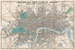
Whitbread's New Plan of London.
sold
- Digital Map Information
- Suitable for large format printing
- DPI: 300
- File Size: 13.63 MB
- File Type: ZIP / TIFF
- ICC color profile embedded
- Delivered instantly via download link
This is the 1851 first edition, second state of Josiah Whitbread's New Plan of London. The map is dated February 26, 1851, a little over two months before the May 1st opening of London's 'Great Exhibition of the Works of Industry of All Nations,' or simply the Great Exhibition. The Great Exhibition was the first of many World's Fairs, which became important venues for trade and nationalistic advancement. The exhibition space, known as the 'Crystal Palace', is depicted in Hyde Park. The Exhibition was planned by Prince Albert, Queen Victoria's husband, and became a spectacular financial success. The surplus funds were used to found the Victoria and Albert Museum, the Science Museum, and the Natural History Museum, all of which are located in South Kensington near Hyde Park. (more details)
Map of Victorian London popular with Jack the Ripper researchers showing parks, streets, and important buildings.
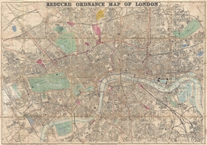
Whitbread's Reduced Ordnance Map of London.
sold
- Digital Map Information
- Suitable for large format printing
- File Size: 33.51 MB
- File Type: ZIP / TIFF
- ICC color profile embedded
- Delivered instantly via download link
A very attractive large map of London, England, published by Whitbread in 1873. As this title suggests, this map was reduced from the Ordnance Survey for the consumer market. The map covers from the West End around Edgeware Road to Parcens Garden, Victoria Park, ... (more details)