
Woodville, William Woodville (sold)

William Woodville (1744 - ????) was a Liverpool, England, based sea captain and slave trader who worked the Sierra Leone region and the African Windward Coast. His son, also William Woodville (June 10, 1763 - ????) was also a captain in the slave trade.
For slavers, by slavers.
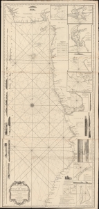
New Chart of the Coast of Africa between Cape Formoso and Cape Negro, with the Adjacent Islands.
sold
- Digital Map Information
- Suitable for large format printing
- DPI: 600
- File Size: 2103.64 MB
- File Type: ZIP / TIFF
- ICC color profile embedded
- Delivered instantly via download link
An intriguing 1794 nautical map of West Africa south of the Bite of Biafra. The chart was issued by Laurie and Whittle, but made for the African slave trade based on the detailed reports of prominent slavers and slave ship captains: Robert Norris, William Woodville, and Archibald Dalzel. It appeared at the height of the Triangle Trade, when countless Africans were captured and sold into captivity in the Americas. As such, the chart offers significant insights into the African Trade along central-west coasts. (more details)