
Anderson, Hugh (sold)

Hugh Anderson (c. 1790 - 1854, fl. 1811 - 1854) was an American line and stipple engraver based in Philadelphia, PA. Anderson was not specifically a cartographic engraver and his corpus includes landscape views, allegorical images, frontispieces, architectural, anatomical, and animal engravings, as well as maps. His name appears in Philadelphia directories from 1811 to 1819 and again from 1822 to 1824. Anderson was most likely Scottish and probably trained in Scotland before immigrating to the United States. There is some suggestion that Anderson was also a watchmaker and that he relocated to Ohio, where he may have continued his business and even engaged in politics under the Democratic Party. His apprentices may have included John Hugh Williams of Iowa (his son in law) and Genin Sylvester of Ohio.
Among the earliest American maps to show the United States stretching from coast to coast.
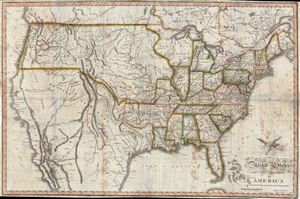
United States of America Corrected and Improved from the Best Authorities
sold
- Digital Map Information
- Suitable for large format printing
- DPI: 300
- File Size: 54.52 MB
- File Type: ZIP / TIFF
- ICC color profile embedded
- Delivered instantly via download link
An exceptional and uncommon 1820 map of the United States issued by Benjamin Warner. Following closely after John Melish's superb wall map of 1819, this is one of the earliest maps to depict the United States extending from Atlantic to Pacific. As Wheat notes, this map is significant as one of several issued up to about 1823 that galvanized geographic ideas regarding the only tenuously explored lands beyond the Rocky Mountains, including the mythical 'River of the West' or 'Buenaventura' and other speculations. (more details)
Among the earliest American maps to illustrate the United States stretching from coast to coast.
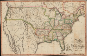
United States of America Corrected and Improved from the Best Authorities.
sold
- Digital Map Information
- Suitable for large format printing
- Full resolution TIFF file
- ICC color profile embedded
- Delivered instantly via download link
An uncommon 1820 map of the United States by Benjamin Warner. Following on John Melish's wall map of 1819, this is one of the earliest maps to depict the United States extending from the Atlantic to the Pacific. As Wheat notes, this map is significant as one of several issued up to about 1823 that galvanized geographic ideas regarding the only tenuously explored lands beyond the Rocky Mountains, including the mythical 'River of the West' or 'Buenaventura' and other speculations. (more details)