
Service Geographique de L'Armee (sold)

Service Geographique de L'Armee (fl. 1887 - 1940) was a French military mapping service. They published from 14c. Rue de Grenelle, Paris, France.
A unique Boxer Rebellion field map of Beijing representing the most detailed map of this region at time.
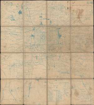
[Peking and Environs]
sold
- Digital Map Information
- Suitable for large format printing
- File Size: 21.53 MB
- File Type: ZIP / TIFF
- ICC color profile embedded
- Delivered instantly via download link
An exceptional c. 1900 Boxer Rebellion period map of Beijing and vicinity, China. Presented as a diazo or whiteprint (reverse cyanotype), with some manuscript, this map while complete onto itself, represents a small part of a now-lost French Service Géographique manuscript map of the environs of Beijing prepared for field use during the Boxer Rebellion (1899 - 1901). Offering greater detail than any known contemporaneous map of the region, the exceptional cartography here was not eclipsed until the 1930s and 40s. (more details)
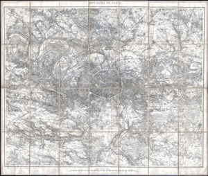
Environs de Paris 80.000e.
sold
- Digital Map Information
- Suitable for large format printing
- File Size: 27.39 MB
- File Type: ZIP / TIFF
- ICC color profile embedded
- Delivered instantly via download link
This is a splendid large size case map of Paris, France, and its environs prepared by the French Service Geographique de L'Armee. Extends from Vigny in the northwest to Rambouillet in the southwest to Marchemoret in the northeast and Solers in the southeast. ... (more details)
European interest in the Russo-Japanese War.
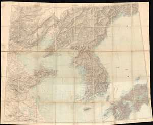
Tcheng-Te Fou. Moukden. Vladivostok.
sold
- Digital Map Information
- Suitable for large format printing
- Full resolution TIFF file
- ICC color profile embedded
- Delivered instantly via download link
This is a gigantic c. 1904 wall map of Korea and northeastern China during the era of the Russo-Japanese War. Compiled from nine Service Géographique de l'Armée maps, this unique piece likely helped French military officials visualize the fighting in the region during the war. Incredibly detailed, myriad cities and towns are labeled throughout. Particular focus is paid to the Liaodang Peninsula and the spur rail line constructed by the Russians connecting Mukden and Port Arthur, where every stop is identified. Other rail lines around the region are illustrated as well, along with roads, rivers, and mountain ranges. Beijing (Pekin), Nanjing (Nankin), Seoul, and Vladivostok are all appear. (more details)