
Basset and Chiswell (sold)

Thomas Basset (1637 - 1699) and Richard Chiswell (January 4, 1640 - May 3, 1711), publishing as Basset and Chiswell (1675 - 1676), were English booksellers and map publishers active in the latter half of the 17th century. Though both Basset and Chiswell worked independently, their most significant cartographic accomplishment was their joint purchase of John Speed's map plates, from an enigmatic figure known only as Willoughby, in 1675. Basset and Chiswell, working in concert, added and expanded Speed's Theatre of the Empire of Great Britaine, publishing a new and influential edition of the atlas in 1676. Following the publication of the Theatre the partnership dissolved, the Basset and Chiswell imprint appearing on no subsequent maps, and both went on to separate careers. Basset published several other works and ran a bookstore on Fleet Street, London, until declaring bankruptcy in 1696. He died just a few years later in 1699. Chiswell was somewhat more successful, publishing numerous maps and books well into the 1700s. He was praised and admired by his contemporaries; one of whom, John Dunton, writing in 1705 comments that Chiswell "Well deserves the title of Metropolitan Bookseller of England, if not the whole world. His name at the bottom of a title-page does sufficiently recommend the book. He has not been known to print either a bad book, or on a pad paper". Chiswell died on May 3 of 1711 and is commemorated by a monument, erected by his son and still visible in St. Botolph-without-Aldgate Church.
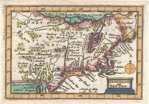
New England and New York.
sold
- Digital Map Information
- Suitable for large format printing
- DPI: 300
- File Size: 0.76 MB
- File Type: ZIP / TIFF
- ICC color profile embedded
- Delivered instantly via download link
An attractive 1675 miniature variant on John Speeds rare miniature map of New England and New York issued by Thomas Bassett and Richard Chiswell. This map was included with the popularly termed 'miniature Speed,' an octavo version of Speeds great folio atlas. ... (more details)
First edition of John Speed's transitional and influential map of Virginia, Maryland, and the Chesapeake Bay.
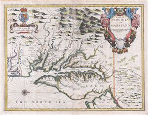
A Map of Virginia and Maryland.
sold
- Digital Map Information
- Suitable for large format printing
- DPI: 300
- File Size: 13.73 MB
- File Type: ZIP / TIFF
- ICC color profile embedded
- Delivered instantly via download link
A fine full color example of Francis Lamb's 1676 map of Virginia, Maryland, and the Chesapeake Bay. Oriented to the west, Lamb's map covers from Albemarle Sound to the Susquehanna River and from the Appalachian Mountains to the Delaware Bay and New Jersey, ... (more details)
Britain's new acquisition, New York, Revealed.
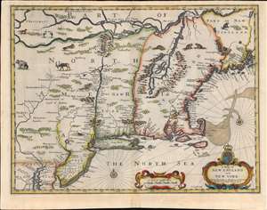
A Map of New England and New York.
sold
- Digital Map Information
- Suitable for large format printing
- Full resolution TIFF file
- ICC color profile embedded
- Delivered instantly via download link
This is beautiful example of the 1676 map of New England engraved by Francis Lamb, to be added to the final edition of John Speed's Prospect of the Most Famous Parts of the World. This was among the maps Bassett and Chiswell commissioned Lamb to produce in order to bring Speed's atlas up to date. The map is a derivative of Jan Jansson's 1651 'prototype', but alters the Dutch topography with English place names. It is notable for a wealth of 'firsts'. This is the first obtainable English map to show the American Northeast's change of hands from Dutch to Britain suzerainty. As such, it emphasizes the potential wealth of the recent British conquest. It is one of the first printed maps to refer to both Manhattan and surrounding region as 'New York.' It is also among the first maps to correctly place Boston. (more details)
The first atlas map to show California as an Island.
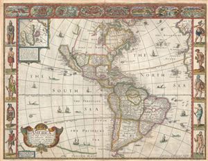
America with those known parts in that unknowne world both people and manner of buildings discribed and inlarged by I.S. Ano 1626.
sold
- Digital Map Information
- Suitable for large format printing
- DPI: 300
- File Size: 10.02 MB
- File Type: ZIP / TIFF
- ICC color profile embedded
- Delivered instantly via download link
A nice example of John Speed's 1626 map of America here in its fourth or 1676 state. One of the most iconic maps of America ever made, this map is surrounded by decorative vignettes illustrating the indigenous peoples and cities of the Americas. This map ... (more details)
Beautifully colored map of Poland - with views of Krakow and Breslau!
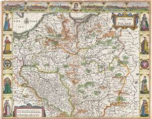
A Newe Mape of Poland.
sold
- Digital Map Information
- Suitable for large format printing
- DPI: 300
- File Size: 11.83 MB
- File Type: ZIP / TIFF
- ICC color profile embedded
- Delivered instantly via download link
This is a 1676 John Speed carte-a-figure map of Poland issued at the end of the Second Polish-Ottoman War. The map depicts from the Baltic Sea and eastern Bohemia to Prussia, Lithuania, and western Russia and from the Baltic to Kraków (Cracow; Cracovia). ... (more details)
Decorative Carte-a-Figure map of Poland!
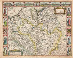
A Newe Mape of Poland.
sold
- Digital Map Information
- Suitable for large format printing
- Full resolution TIFF file
- ICC color profile embedded
- Delivered instantly via download link
This is a 1676 John Speed carte-a-figure map of Poland issued at the end of the Second Polish-Ottoman War. The map depicts from the Baltic Sea and eastern Bohemia to Prussia, Lithuania, and western Russia and from the Baltic to Kraków (Cracow; Cracovia). ... (more details)