
Beers, Daniel Glover (sold)

Daniel Glover Beers (October 19, 1841 - February 12, 1913) was an American farmer, surveyor, and mapmaker active in Connecticut. He is the brother of Silas Norman Beers (September 3, 1837 - May 12, 1873), son of Charles Henry Beers (November 3, 1813 - March 5, 1892), and nephew of Frederick William Beers (August 17, 1839 - September 8, 1933), all prominent mapmakers. D. G. Beer's name appears on the imprint of several Beers maps, including the large 1860 wall map of Philadelphia and vicinity, with Dunning Jackson Lake (1836 - 1915). In 1865 he partnered with one 'Pomeroy' of Rochester, New York to publish an Atlas of Delaware under the imprint of 'Pomeroy and Beers'. This business dissolved in 1880, after which he published independently as 'D. G. Beers and Co.' In the same year he patented a folding canvas canopy for covered wagons, a business that became extremely prosperous.
Best 19th century map of Pawtucket.
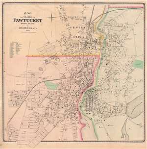
Map of the Village of Pawtucket Rhode Island.
sold
- Digital Map Information
- Suitable for large format printing
- File Size: 43.28 MB
- File Type: ZIP / TIFF
- ICC color profile embedded
- Delivered instantly via download link
A striking large-scale 1870 map of Pawtucket, Rhode Island by Daniel Glover Beers. The map details the town of Pawtucket on both sides of the Pawtucket and Blackstone rivers, just north of Providence and Narragansett Bay. The meticulously detailed map names every street and building lot, in many cases offering building footprints and naming property owners. (more details)