
BestOPS Travel Service (sold) (Best Stops)

BestOPS (fl. 1948-1953), a.k.a. Best Stops Travel Service, was an American map-centered advertising company that arrived, and vanished, in the period following World War II (1939 - 1945) but preceding the c. 1955 explosion of the Interstate Highway System. The company's sole apparent product was a series of maps printed on diner napkins - hence, Mapkins - intended to promote roadside restaurants and cafes along the scenic routes to America's national parks and wonders. Thus, the mapkins capture the moment in American automotive history in which newly prosperous families took to the roads and ate their way across America, one diner at a time.
The company's address - always printed on the Mapkin - appears briefly to have been in Portland, Oregon, but then to have relocated to Utah. A few show an address in Provo, but the majority we have identified show one of several addresses in Salt Lake City; after 1951, mainly in the Beason Building. Most of the Mapkins can be dated, with reasonable confidence, based on the rapidly-changing landscape of the restaurant trade. Our research suggests that most were composed between 1948 and 1953.
The Salt Lake City directories of 1951 and 1952 are illuminating. The '51 directory includes an entry for BestOPS Travel Service, naming a Dorius E. Black as manager. In 1952, the directory names instead 'Best Stops Travel Service;' Black is listed as Vice President and Sales Manager, with its president listed as Lincoln C. White. Lincoln Carter White (1919 - 1986) was a successful Salt Lake City jeweler who had offices in the Beason Building corresponding to the addresses found on Mapkins after 1951. We suspect White not to have been the creator of the Mapkins, but an investor.
Dorius Ether Black (March 15, 1918 - June 29, 1985) is a better candidate. Before his wartime service in the navy reserves he had travelled abroad as an LDS missionary. We see no indication of his profession between 1946 and 1950; The 1950 Census listed him as separated, and living in Provo with his mother and siblings. His profession was listed as a salesman with 'Travel Service,' with two younger sisters working as stenographers for the same (we suspect that it is the sisters, Alma Jane and Ireta, who actually drew the Mapkins, while Dorius traveled, sold, and researched them). Up until 1951, BestOPS Travel Service operated via post office box addresses, in Provo, Salt Lake City, and briefly in Portland, Oregon. We suspect that Black started BestOPS and ran it out of his mother's house, with the assistance of his sisters, while he travelled around the country selling his mapkins to various diners en route. As a LDS missionary, he may well have been traveling as a proselytizer at the same time. In 1951 or 1952, he sold the business, or a share of it, to White: perhaps with an eye to providing a home for his fiancée, whom he would marry in 1952. White's involvement brought changes: more industrial printing methods, slicker branding, and a less-confusing business name - while as Vice President and Sales Manager, Black continued to travel and work his sales contacts. But before long, his travels for Best Stops brought him to Florida, and he decided to stay there - first in St. Petersburg, where he would begin work for a brokerage, and then to Orlando. Without Black, Best Stops appears to have ceased producing new Mapkins. White seems to have kept the business until it was struck from the Utah tax rolls in November 9, 1973, but while it appears likely that Best Stops would have continued trying to sell its back stock, we have seen no Mapkin that could credibly have been made any later than 1955.
We would like to extend our gratitude to Doug Misner, Library and Collections Manager of the Utah Historical Society, for his crucial assistance in identifying the individuals behind these fascinating pieces of cartographic Americana.
The company's address - always printed on the Mapkin - appears briefly to have been in Portland, Oregon, but then to have relocated to Utah. A few show an address in Provo, but the majority we have identified show one of several addresses in Salt Lake City; after 1951, mainly in the Beason Building. Most of the Mapkins can be dated, with reasonable confidence, based on the rapidly-changing landscape of the restaurant trade. Our research suggests that most were composed between 1948 and 1953.
The Salt Lake City directories of 1951 and 1952 are illuminating. The '51 directory includes an entry for BestOPS Travel Service, naming a Dorius E. Black as manager. In 1952, the directory names instead 'Best Stops Travel Service;' Black is listed as Vice President and Sales Manager, with its president listed as Lincoln C. White. Lincoln Carter White (1919 - 1986) was a successful Salt Lake City jeweler who had offices in the Beason Building corresponding to the addresses found on Mapkins after 1951. We suspect White not to have been the creator of the Mapkins, but an investor.
Dorius Ether Black (March 15, 1918 - June 29, 1985) is a better candidate. Before his wartime service in the navy reserves he had travelled abroad as an LDS missionary. We see no indication of his profession between 1946 and 1950; The 1950 Census listed him as separated, and living in Provo with his mother and siblings. His profession was listed as a salesman with 'Travel Service,' with two younger sisters working as stenographers for the same (we suspect that it is the sisters, Alma Jane and Ireta, who actually drew the Mapkins, while Dorius traveled, sold, and researched them). Up until 1951, BestOPS Travel Service operated via post office box addresses, in Provo, Salt Lake City, and briefly in Portland, Oregon. We suspect that Black started BestOPS and ran it out of his mother's house, with the assistance of his sisters, while he travelled around the country selling his mapkins to various diners en route. As a LDS missionary, he may well have been traveling as a proselytizer at the same time. In 1951 or 1952, he sold the business, or a share of it, to White: perhaps with an eye to providing a home for his fiancée, whom he would marry in 1952. White's involvement brought changes: more industrial printing methods, slicker branding, and a less-confusing business name - while as Vice President and Sales Manager, Black continued to travel and work his sales contacts. But before long, his travels for Best Stops brought him to Florida, and he decided to stay there - first in St. Petersburg, where he would begin work for a brokerage, and then to Orlando. Without Black, Best Stops appears to have ceased producing new Mapkins. White seems to have kept the business until it was struck from the Utah tax rolls in November 9, 1973, but while it appears likely that Best Stops would have continued trying to sell its back stock, we have seen no Mapkin that could credibly have been made any later than 1955.
We would like to extend our gratitude to Doug Misner, Library and Collections Manager of the Utah Historical Society, for his crucial assistance in identifying the individuals behind these fascinating pieces of cartographic Americana.
AKA: Best Stops
A charming cartifact of Scenic Utah.
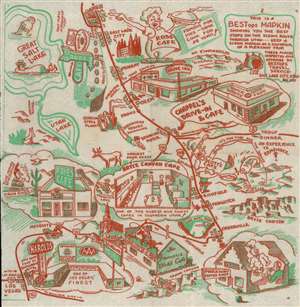
This Is A BESTops MAPKIN Showing you the best stops on the scenic route through Utah ---- keep a scenic Mapkin as a souvenir of a pleasant trip. These Places inspected and approved by BEStops Travel Service Box Salt Lake City Utah. Box 1105.
sold
- Digital Map Information
- Suitable for large format printing
- File Size: 10.32 MB
- File Type: ZIP / TIFF
- ICC color profile embedded
- Delivered instantly via download link
A rare survival: a 1948 map of parts of Arizona, Utah and Nevada, printed in two colors on a diner napkin. This 'Mapkin' represents a pictorial icon of the pre-interstate road trip, focusing specifically on the region from Las Vegas (here misspelled 'Los Vegas') and the Grand Canyon in the south, to the Great Salt Lake, Salt Lake City, and Mount Timpanogos in the north. The region's natural monuments were the draw for postwar tourists, but the primary focus of this map is on the area's restauranteurs. Throughout are interspersed a charming array of iconic travelers' destinations: historical sites and monuments, natural landmarks, and recommendable eateries to support the hungry tourists en route between. (more details)
A charming cartifact of Scenic Utah.
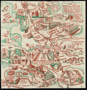
This Is A BESTops MAPKIN Showing you the best stops on the scenic route through Utah ---- keep a scenic Mapkin as a souvenir of a pleasant trip. These Places inspected and approved by BEStops Travel Service Box Salt Lake City Utah. Box 1105.
sold
- Digital Map Information
- Suitable for large format printing
- File Size: 28.76 MB
- File Type: ZIP / TIFF
- ICC color profile embedded
- Delivered instantly via download link
A rare survival: a 1948 map of parts of Arizona, Utah and Nevada, printed in two colors on a diner napkin. This 'Mapkin' represents a pictorial icon of the pre-interstate road trip, focusing specifically on the region from Las Vegas (here misspelled 'Los Vegas') and the Grand Canyon in the south, to the Great Salt Lake, Salt Lake City, and Mount Timpanogos in the north. The region's natural monuments were the draw for postwar tourists, but the primary focus of this map is on the area's restauranteurs. Throughout are interspersed a charming array of iconic travelers' destinations: historical sites and monuments, natural landmarks, and recommendable eateries to support the hungry tourists en route between. (more details)
Pre-Interstate Arizona Tourist Icon: artifac of bygone way-stations on storied highways
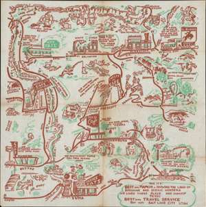
This Is A BESTops MAPKIN - Showing The Land of Sunshine and Scenic Wonders We Liked These Place and Suggest To You. BESTops Travel Service Box 1651 Salt Lake City Utah.
sold
- Digital Map Information
- Suitable for large format printing
- File Size: 9.94 MB
- File Type: ZIP / TIFF
- ICC color profile embedded
- Delivered instantly via download link
A rare survival: a 1948 map of northwestern Arizona, printed in two colors on a diner napkin. This 'Mapkin' represesnts a pictorial icon of the pre-interstate Arizona road trip, focusing specifically on the region encompassed by Yuma and Phoenix, Arizona in the south, up to the Grand Canyon in the north. (more details)
Southwestern Arizona and the Coachella Valley - 50 years before Coachella!
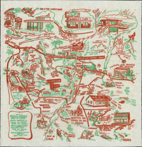
This is a BESTops Mapkin...
sold
- Digital Map Information
- Suitable for large format printing
- File Size: 12.26 MB
- File Type: ZIP / TIFF
- ICC color profile embedded
- Delivered instantly via download link
A rare survival: a 1948 'BESTops Mapkin' of southern California and Arizona along the Mexican border, printed in two colors on a diner napkin. This 'Mapkin' represents a pictorial icon of the pre-interstate road trip. (more details)
Get Your Kicks (and Chicken In A Basket) On Route 66.
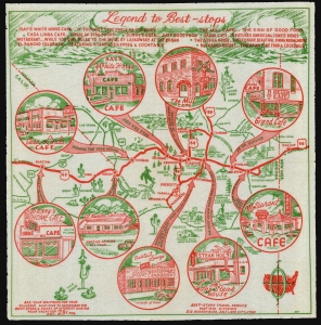
Legend to Best-Stops.
sold
- Digital Map Information
- Suitable for large format printing
- File Size: 31.27 MB
- File Type: ZIP / TIFF
- ICC color profile embedded
- Delivered instantly via download link
This is a 1952 map of northern Arizona, printed in two colors on a diner napkin. This 'Mapkin, ' produced by the Best Stops Travel Service of Salt Lake City, Utah, represents a pictorial icon of the pre-interstate Arizona road trip, focusing specifically on the region along the fabled Route 66 from Gallup, New Mexico to Barstow California. The region covered runs from Phoenix, Arizona in the south, up to the Grand Canyon in the north. This was an area that BestOPS had covered in 1948; the present work not only features different restaurants, but also sharpens the focus on Route 66 as the major corridor of the region. (more details)
Get Your Kicks (and Chicken In The Basket) On Route 66.
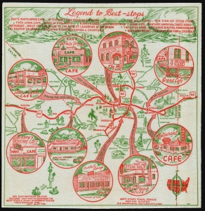
Legend to Best-Stops.
sold
- Digital Map Information
- Suitable for large format printing
- File Size: 30.48 MB
- File Type: ZIP / TIFF
- ICC color profile embedded
- Delivered instantly via download link
A scarce cartifact, and our next discovery in the series of BestOPS Mapkins: a 1952 map of northern Arizona, printed in two colors on a diner napkin. This 'Mapkin' represents a pictorial icon of the pre-interstate Arizona road trip, focusing specifically on the region along the fabled Route 66 from Gallup, New Mexico to Barstow California. The region covered runs from Phoenix, Arizona in the south, up to the Grand Canyon in the north. (more details)
Get Your Kicks (and Chicken In A Basket) On Route 66.
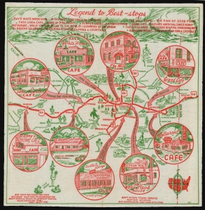
Legend to Best-Stops.
sold
- Digital Map Information
- Suitable for large format printing
- File Size: 29.4 MB
- File Type: ZIP / TIFF
- ICC color profile embedded
- Delivered instantly via download link
This is a 1952 map of northern Arizona, printed in two colors on a diner napkin. This 'Mapkin', produced by the Best Stops Travel Service of Salt Lake City, Utah, represents a pictorial icon of the pre-interstate Arizona road trip, focusing specifically on the region along the fabled Route 66 from Gallup, New Mexico to Barstow California. The region covered runs from Phoenix, Arizona in the south, up to the Grand Canyon in the north. This was an area that BestOPS had covered in 1948; the present work not only features different restaurants, but also sharpens the focus on Route 66 as the major corridor of the region. (more details)
Charming cartifact of the diners and tiki rooms of Utah.
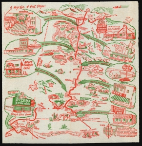
A Map-kin of Best Stops.
sold
- Digital Map Information
- Suitable for large format printing
- File Size: 28.37 MB
- File Type: ZIP / TIFF
- ICC color profile embedded
- Delivered instantly via download link
A scarce cartifact, this an 1952 map of central and western Utah, from Idaho to Colorado and the Nevada border, printed in two colors on a diner napkin. This 'Mapkin' represents a pictorial icon of the pre-interstate road trip, focusing specifically on the region from Las Vegas and the Grand Canyon in the south, to Logan, Utah and the Idaho border in the north. It is visually entertaining, depicting not only the roadside cafes and motels advertised within the map but also wildlife, cowboy scenes, and such entertainments as a fellow floating in the Great Salt Lake enjoying a newspaper titled 'You Can't Sink'. (more details)
Eat your way from Kansas into the Colorado Rockies.
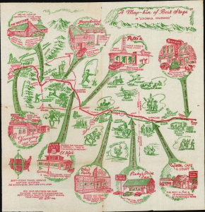
A Map-kin of Best-Stops in 'Colorful Colorado'.
sold
- Digital Map Information
- Suitable for large format printing
- Full resolution TIFF file
- ICC color profile embedded
- Delivered instantly via download link
This is a circa 1953 map of central and southeastern Colorado and part of Kansas, printed in two colors on a diner napkin. This 'Map-kin', produced by the Best Stops Travel Service of Salt Lake City, Utah, is a pictorial icon of the pre-interstate Colorado road trip, focusing specifically on the region along U.S. routes 24 and 50 stretching from Glenwood Springs in the West to Garden City, Kansas. The route covered on the map passed through Colorado Springs and Pueblo; the map highlights diners and lodges on the way. Its decoration emphasizes both the region's cowboy and gold rush history, and the attractions for the automotive sightseer and sportsman. (more details)
'Eat beef eat beef it's a mighty good food/ It's a grade A meal when I'm in the mooooood.' ~ Reverend Horton Heat
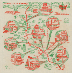
A Map-kin of Best-Stops.
sold
- Digital Map Information
- Suitable for large format printing
- Full resolution TIFF file
- ICC color profile embedded
- Delivered instantly via download link
This is a circa 1953 map of central Colorado, northeastern New Mexico, western Oklahoma, and the Texas Panhandle printed in two colors on a diner napkin. This 'Map-kin', produced by the Best Stops Travel Service of Salt Lake City, Utah, is a pictorial icon of the pre-interstate Colorado road trip, focusing specifically on the region along U.S. route 87 (from Denver, Colorado to Childress, Texas) and U.S. route 54 (from Hooker, Oklahoma to Nara Visa, New Mexico); the routes intersect in Dalhart, Texas. The route covered on the map passes through Colorado Springs and Pueblo; the map highlights diners and lodges on the way. Its decoration emphasizes both the region's cowboy history, and the natural attractions for the automotive sightseer and sportsman. (more details)