
Breese, Samuel (sold)

Samuel Breese (September 27, 1802 - October 14, 1873) was an American cartographer who co-published The Cerographic Atlas of the United States with Sidney Edwards Morse.
A map of Florida created using cerography, an early method of color printing using wax.
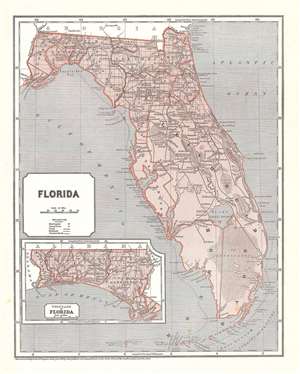
Florida.
sold
- Digital Map Information
- Suitable for large format printing
- DPI: 600
- File Size: 15.53 MB
- File Type: ZIP / TIFF
- ICC color profile embedded
- Delivered instantly via download link
This is an 1845 Sidney Edwards Morse and Samuel Breese map of Florida. The map depicts the state from the Apalachicola (Appalachicola) River to the Atlantic Ocean and from Georgia to the Straits of Florida and the Florida Keys. Wonderfully engraved, numerous ... (more details)
After the Second Seminole War - U.S. Power in the region consolidated.
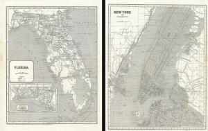
Florida. / New York and Vicinity.
sold
- Digital Map Information
- Suitable for large format printing
- DPI: 600
- File Size: 54.74 MB
- File Type: ZIP / TIFF
- ICC color profile embedded
- Delivered instantly via download link
Maps of the Florida and New York City in 1845, issued for Sidney E. Morse's Cerographic Atlas. The maps are printed back-to-back. The more significant of the two maps, depicting Florida, captures the state as it emerged from the Second Seminole War and the United States solidified its control over the territory. (more details)