
Brewer, Harrison Gaston (sold)

Harrison Gaston Brewer (September 21, 1855 - January 22, 1920) was an American hydrographic draftsman based in Washington, D.C., active during the late 19th and early 20th centuries. Born in Annapolis, Maryland, he was a son of Nicholas Brewer (1808 - 1874), formerly adjutant general of Maryland. His documented cartographic career centered on the United States Navy's Hydrographic Office. An early National Geographic Society membership list identifies him by his full name and gives the Hydrographic Office as his professional address; the Navy Department's personnel return for 1891 lists him as a draftsman employed throughout that year. A family biography published in 1915 likewise records his connection with the office. Brewer married Marcie Elliott of Greenville, Tennessee, and they had a son and three daughters. Their daughter Marcy Angela died in Washington on December 24, 1906, aged seventeen; his wife, son, and two other daughters survived him. Brewer died in 1920, and his remains were buried in Washington's Congressional Cemetery on July 14 of that year.
Manuscript highlighting of hazards in the Rio de la Plata.
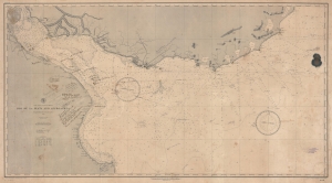
East Coast of South America. Rio de la Plata and Approaches.
sold
- Digital Map Information
- Suitable for large format printing
- File Size: 83.98 MB
- File Type: ZIP / TIFF
- ICC color profile embedded
- Delivered instantly via download link
A fascinating working nautical chart, this is an 1888 U.S. Navy Hydrographic Office map of the Rio de la Plata, South America. The map features manuscript annotations following several voyages detailing lights and hazards. It offers unique insight into the navigation of one of the world's most famous estuaries. (more details)
Charting the Rio de la Plata.
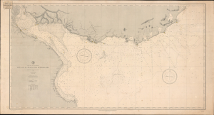
Rio de la Plata and Approaches.
sold
- Digital Map Information
- Suitable for large format printing
- Full resolution TIFF file
- ICC color profile embedded
- Delivered instantly via download link
This is the June 1888 edition of the United States Hydrographic Office's nautical chart of the Río de la Plata and its Atlantic approaches, bearing the label of New York nautical instrument makers and chart agents D. Eggert's Sons. Covering the passage to Buenos Aires past Montevideo, the chart emphasizes the soundings, banks, and navigational lights essential to negotiating this broad, shallow estuary. Its commercial label links the Navy's chart-production program to the private businesses that supplied navigators with charts, chronometers, and instruments. (more details)