
Bullock, Leslie George (sold)

Leslie George Bullock (March 12, 1895 – November 29, 1971) was an English civil servant and cartographer active London during the middle part of the 20th century. Bullock was educated at the Alleyns School of Dulwich. After his schooling he took work with the Union Assurance Company with whom he trained as a fire surveyor. When World War I broke out he joined the Territorial Army. After the war he took work with the Port of London, where he remained until about 1932, when he was transferred to Scotland. Bullock enjoyed visiting London where he felt the truest way to experience the city was by riding the bus or talking a walk, where he would notice and appreciate little vignettes of life. This idea transferred to his cartographic designs, which are defined by small slice-of-life vignettes. All of his cartographic work was published by the firm of John Bartholomew. His most notable maps are his Children's Map of London, his historical maps of England, Scotland, Ireland, and Wales, his city plan of Glasgow, and his United Nations Map of the World.
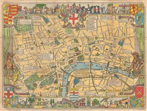
County of London.
sold
- Digital Map Information
- Suitable for large format printing
- File Size: 24.88 MB
- File Type: ZIP / TIFF
- ICC color profile embedded
- Delivered instantly via download link
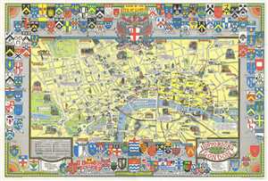
A colorful and attractive c. 1955 pictorial map of London printed by John Bartholomew & Sons. The comp covers central London from Hyde Park to Aldgate and from Green Park to Waterloo Station. The map was issued to raise funds for the Hospital for Sick ... (more details)
Whimsical pictorial map of London.
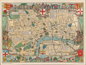
A colorful and attractive c. 1955 pictorial map of London printed by John Bartholomew & Sons. The comp covers central London from Hyde Park to Aldgate and from Green Park to Waterloo Station. The map was issued to raise funds for the Hospital for Sick ... (more details)
London legends and folklore.
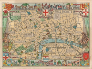
A colorful c. 1955 pictorial map of London by Leslie G. Bullock. The map covers central London from Hyde Park to Aldgate and from Green Park to Waterloo Station. The map was issued to raise funds for the Hospital for Sick Children, Great Ormond Street London. It identifies most major roads with important buildings rendered pictorially. The whole is filled with charming quotations from various authors ranging from Rudyard Kipling, Alfred Noyes, Benjamin Franklin, and others. Surrounded by decorative work intended to represent London life and folklore. (more details)
Impressive pictorial map illustrating the history of England and Wales.
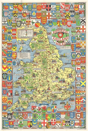
Historical Map of England and Wales.
sold
- Digital Map Information
- Suitable for large format printing
- File Size: 34.7 MB
- File Type: ZIP / TIFF
- ICC color profile embedded
- Delivered instantly via download link
A wonderful large 1963 format pictorial map illustrating the history of England and Wales drawn by Leslie Bullock. The map coves all of England and Scotland with historical locations and events illustrated pictorially in the form of charming cartoon ... (more details)
A delightful and colorful historical pictorial map of Ireland.
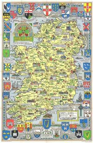
Historical Map of Ireland.
sold
- Digital Map Information
- Suitable for large format printing
- File Size: 28.5 MB
- File Type: ZIP / TIFF
- ICC color profile embedded
- Delivered instantly via download link
This is a delightful 1969 L.G. Bullock pictorial historical map of Ireland. Bullock's map shows the entire Emerald Isle as well as a small amount of the sea. The map is very elaborate and includes several intriguing aspects. (more details)
A delightful and colorful historical pictorial map of Ireland.
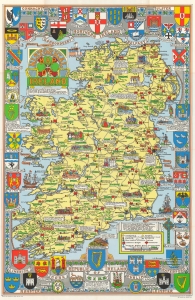
This is a delightful 1969 L.G. Bullock pictorial historical map of Ireland. (more details)
Scottish history.
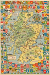
This is a c. 1962 Leslie Bullock pictorial historical map of Scotland. Bullock highlights events in Scottish history and marks castles, cathedrals, and other historic sites. (more details)
Scottish history.
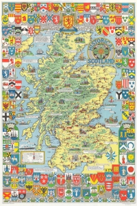
This is a c. 1962 Leslie Bullock pictorial historical map of Scotland. Bullock highlights events in Scottish history and marks castles, cathedrals, and other historic sites. (more details)
Charming pictorial map of London intended for use by children.
A colorful and attractive c. 1978 pictorial map of London printed by John Bartholomew & Sons. The historical map covers central London from Hyde Park to the London Docks and from Westminster to the Inner Circle in the Regent’s Park. Throughout, the ... (more details)