
Chase, Josiah G. (sold)

Josiah G. Chase (December 6, 1819 - July 17, 1903) was an American civil engineer and mapmaker. Born in Atkinson, Maine, Chase was a civil engineer and surveyor who lived in Cambridge, Massachusetts for most of his professional life. He married Susan E. Chase (her maiden name is not known) (c. 1824 - c. 1902) in 1851. Chase published several maps, including a railroad map of Boston and a map of the street rail routes in suburban Boston.
Portland and Casco Bay.
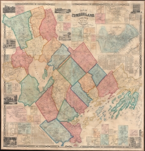
Map of Cumberland County Maine from actual surveys.
sold
- Digital Map Information
- Suitable for large format printing
- File Size: 255.3 MB
- File Type: ZIP / TIFF
- ICC color profile embedded
- Delivered instantly via download link
An attractive 1857 wall map of Cumberland County, Maine, including Portland and Casco Bay. (more details)
Highlights the five different horse-drawn streetcar companies operating in Boston in 1865.
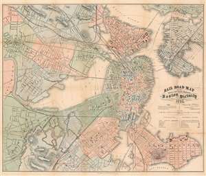
Rail Road Map of All Street and Steam Railroads in Boston and Vicinity.
sold
- Digital Map Information
- Suitable for large format printing
- File Size: 41.68 MB
- File Type: ZIP / TIFF
- ICC color profile embedded
- Delivered instantly via download link
This is an 1865 Josiah G. Chase railroad map of Boston and vicinity. The map depicts the region from Cambridge and Brighton to East Boston and from Chelsea to Roxbury and Dorchester Bay. Railroad lines in and out of central Boston are illustrated in different colors, allowing the viewer to more easily differentiate between steam railroads and streetcars and between the five different streetcar companies. Major intercity railway lines are labeled, such as the Boston and Maine Railroad, the Fitchburg Railroad, and the Old Colony Railroad. Streetcar companies, known as the Metropolitan, Cambridge, Middlesex, Broadway, and Lynn and Boston Railroads, are all illustrated as well, each of which operated streetcars pulled by horses. Electric streetcars would not arrive in Boston until near the turn of the century. Incredibly detailed, individual streets throughout the region are illustrated and labeled, and churches, public school and buildings, and railroads stations are also indicated. These four different types of structures correspond to a key situated along the right border. Other buildings, such as the lunatic asylum, the Navy Yard, and Harvard University, are labeled on the map itself. Red concentric circles emanating from central Boston mark quarter-mile intervals from the intersection of Tremont, Court, and Cornhill Streets. City wards in both Boston and Cambridge are labeled and shaded different colors to allow for easy differentiation. (more details)
Interurban streetcar railways around Boston.
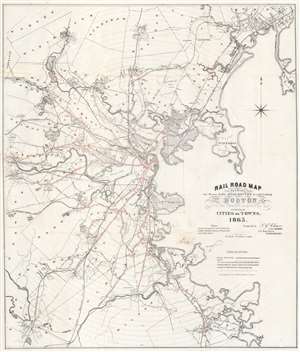
Railroad Map Showing the Street Rail Road Routes in and leading from Boston with the Terminus of Each Road in Suburban Cities and Towns.
sold
- Digital Map Information
- Suitable for large format printing
- File Size: 23.96 MB
- File Type: ZIP / TIFF
- ICC color profile embedded
- Delivered instantly via download link
This is an 1865 Josiah G. Chase railroad map of Boston, Massachusetts, and vicinity. Illustrating the Boston region's streetcar railway and railroad network, the map provides an illuminating view of transportation around Boston just after the American Civil War. (more details)